This article has been extracted and prepared from The Geographical Journal, v. 70, 1927.
Large-size versions of maps and diagrams are available by clicking on them.
[No. 1
21]PROBLEMS OF THE LIBYAN DESERT
John Ball, O.B.E., D.Sc., M.Inst.C.E., F.G.S., Director of Desert Surveys, Egypt
Map following p. 96.
THERE can be few tracts of the Earth’s surface which present such a number and variety of interesting geographical problems as the Libyan Desert. The following are some of the more puzzling of the questions which have been asked at various times since I made my first acquaintance with the desert thirty years ago:
1. Did the Nile, or a branch of it, ever flow through the Libyan Desert to the west of the present Nile Valley?
2. By what natural agency were the great depressions in the Libyan Desert excavated?
3. Can other depressions in this region, besides the much-discussed Wadi Rayan, be considered possible of utilization in[22] connection with irrigation, flood-protection, or drainage of the Nile Delta, or as sources of water-power for Egypt?
4. Whence comes the artesian water of the oases?
5. Why have not certain lakes, such as Sittra and Bahrein, situated as they are in an almost rainless region, long since dried up?
6. Can the present scanty supplies of drinkable water derived from local rainfall along the Egyptian Mediterranean Littoral be supplemented by artesian borings?
7. Are the artesian water-supplies of the oases gradually diminishing?
8. Where shall we look for the mysterious “Zerzura,” or “Oasis of the Blacks”? Are there any other “lost” oases remaining to be discovered?
9. Can the present difficulties of travel in the Libyan Desert, which are chiefly due to scarcity of water, be alleviated by the sinking of new wells?
10. Where are the “Tortoise Marshes” of Ptolemy?
11. What determined the peculiar distribution of the sand-dunes, some of which extend in straight lines for hundreds of kilometres?
12. What is the full extent of the distribution of flint implements and pottery, of which accumulations have been found in what are now among the most desolate parts of the desert, and what light does this throw on human history and climatic changes?
To most of these questions no completely satisfactory answers have as yet been given, though several of them have been the subject of painstaking investigations by many workers. Our knowledge of the facts bearing on them has, however, increased considerably during the past few years; and in the present paper I propose briefly to review the various questions in the light of the latest available data concerning them.
The problems, though they concern a variety of subjects, are very much interwoven with each other, and they are mostly alike in that the first difficulty in any attempt to solve them has always been the incompleteness of our geographical knowledge concerning the Libyan Desert as a whole. If we possessed a series of detailed contour-maps covering the whole of the desert, most of the problems would be in a fair way of solution. But the surveys which would be necessary for such a result are impracticable at present, mainly on the score of expense.
Some fifteen years ago I essayed the construction of a contoured map of the Libyan Desert, in connection with the International “Million” map of the world. But I had to give up the task, finding that there were vast areas without a single observation for altitude, while such altitude-data as did exist were open to errors of a magnitude intolerable for even a preliminary contouring of the areas with which they were concerned. The attempt however was not without its value, because it[23] drew attention to the great lack of reliable levels in the Libyan Desert, and to the necessity of remedying this defect before even an approximately true picture of the general relief could be obtained.
In the interval which has elapsed since my former attempt, a great deal of surveying has been carried out in the Libyan Desert, and in most of this work special attention has been paid to the matter of levels. Two long chains of triangulation have been run westward from the Nile to Siwa Oasis, one viâ the Wadi Natrun and the other viâ Baharia Oasis; another chain has been completed along the coast westward from Alexandria to Sollum, and a triangulation is now being carried out which will eventually connect the oases of Kharga and Dakhla with the Nile Valley. Small local triangulations have also been made in certain areas, such as Dakhla Oasis and in the neighbourhood of Owenat. In all these triangulations vertical as well as horizontal angles have been observed, so that reliable trigonometric altitudes are now available for almost all the points occupied or sighted. In the southern and central parts of the desert, we are still dependent on barometric levels; but the old determinations have mostly been replaced by later and better ones; and the use of motor-car transport, by facilitating exploratory journeys in hitherto untrodden regions, has permitted of a large number of additional determinations being made in tracts where no previous observations of any kind existed.[1]
Owing to the methods employed in the latest barometric determinations, the resulting altitudes are of a much higher order of accuracy than could be hoped for in previous measurements of the kind; in fact, it is believed that they are not so very far behind trigonometric levels in precision. This increased accuracy has been rendered possible by the collaboration of the Egyptian Meteorological Service, which, thanks to the abundant weather-data now received and dealt with by it, is in a position to furnish a close approximation to the sea-level pressure at any point in the deserts at any given instant. The aneroids used in the desert explorations are compared with the standard barometer of the Meteorological Service immediately before the start and immediately after the return of each expedition. At each observation in the desert,[24] the date and time, and the temperature of the air, are noted, as well as the approximate latitude and longitude of the place. On the return of the expedition, the recorded reading is corrected for the error of the aneroid on the standard barometer, and the Meteorological Service is asked to supply the sea-level pressure at the particular place and time of the observation. From the difference of the two pressures and the air temperature, the height of the place above sea-level is then worked out directly with the aid of Jordan’s table of “Barometrische Höhenstufen.” If the place of observation lies considerably above sea-level, a small correction is applied to the observed air-temperature to allow for the temperature-gradient in the air; for of course it is the mean temperature of the air column between the place and sea-level which should be employed in the reduction.
It is unlikely that with this procedure either the sea-level pressures or those observed at the places can be in error by much more than half a millimetre; and consequently, even with some slight uncertainties in the air-temperatures, the resulting altitudes may be expected to be accurate to within about 15 metres when only a single observation has been made, and to within much less than this when, as is usually the case at important points, the altitudes have been calculated from a series of readings spread over several days. That this degree of accuracy is actually attained seems evident on comparison of the levels obtained for the same places on different dates. Thus, for instance, at a camp close to Bir Terfawi, during a stay of five days in January and two days in March 1925, I made in all eighteen aneroid observations. The mean altitude found was 244 metres; the average deviation of a single observation from this mean was 8 metres, the maximum being 16. On the assumption that all sources of error are accidental, the probable error of the mean resulting altitude works out at less than 2 metres, which is about the same as might be expected in trigonometric levelling to the place from the Nile Valley.
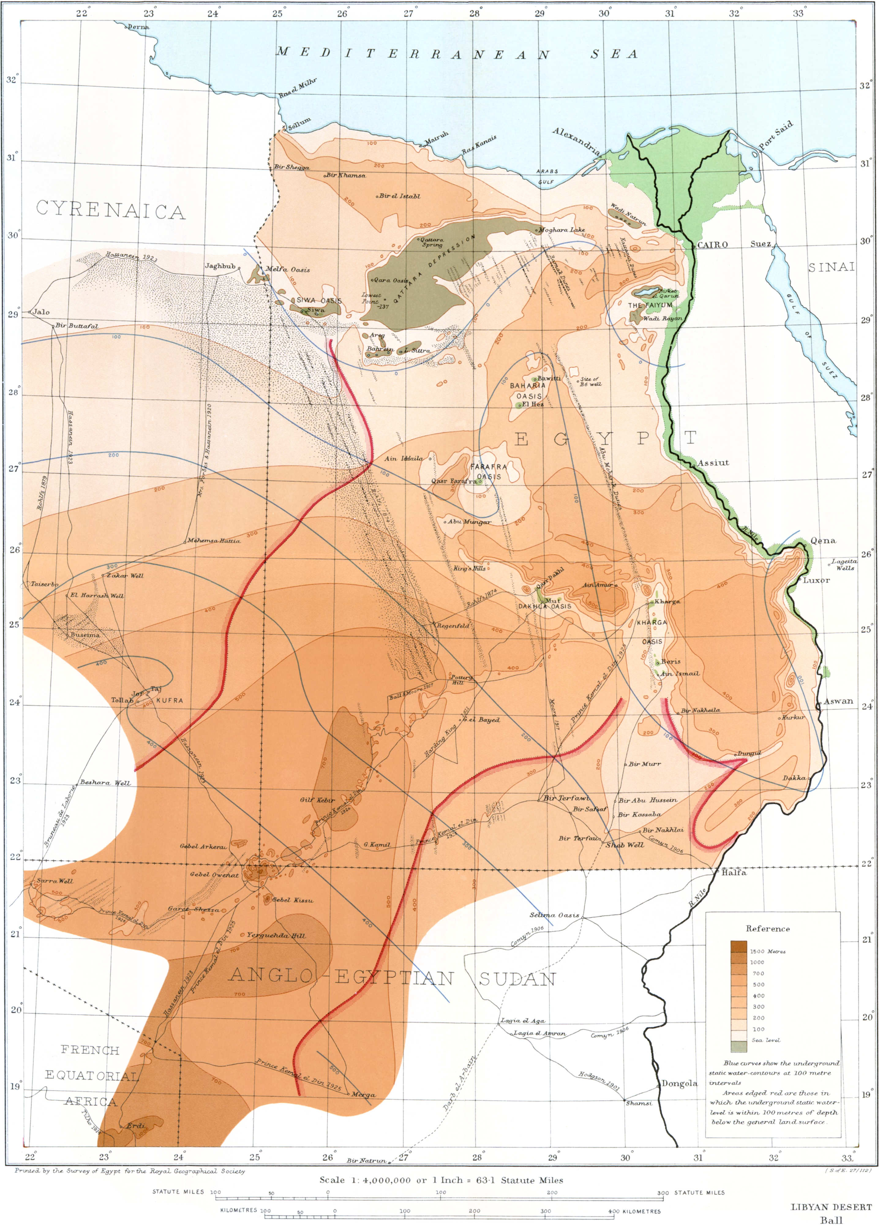
The points in the interior of the Libyan Desert of which the levels are fairly accurately known now number many hundreds, and with the exception of a large blank in the unexplored west, and another between the Nile and Merga in the Northern Sudan, they are fairly well distributed over the country. It therefore seemed to me to be worth while to make another attempt at a contoured map; for the levels now known (though still far too few for contours to be drawn with any great precision) might suffice for the construction of a map on a comparatively small scale and with contours at fairly wide intervals; it was felt that a provisional map of this kind, besides affording at least an approximate general view of the relief, might help towards the solution of one or more of the problems which I have mentioned above. I commenced by sketching in the contours at 100-metre intervals on the original sheets of the 1:500,000 map of Egypt, a revised edition of which is in preparation. They were[25] then reduced to the million scale, and afterwards still further reduced, with additions from my own recent observations around Owenat, Gebel Kissu, and Merga, from Hassanein Bey’s records of his journey between Jalo and El Fasher, from the altitude-data obtained by the Anglo-French Boundary Commission in the Sudan,[2] and from the maps of Prince Kemal el Din’s expedition of 1926 to Owenat and Sarra Well,[3] to form the map following p. 96. The attempt has, I think, fully justified itself, and more than fulfilled the hopes that were entertained concerning it.
Probably the feature that will first strike the attention on glancing at the contoured map is the series of depressions below sea-level stretching westward from near Cairo to Jarabub. The following table gives a list of the principal of these depressions, with the approximate extent of the areas lying below sea-level, and also (where known) the depths below sea-level of their deepest parts. Where the lowest part is covered by a lake, the depth shown is that of the water-surface, not that of the lake-bottom:
| Depression. | Approximate area below sea-level in sq. kiloms. | Approximate depth of deepest part below sea in metres. |
|---|---|---|
| Wadi Natrun | 220 | 23 |
| Faiyum | 700 | 45 |
| Wadi Rayan | 280 | 43 |
| Qattara (including Moghara, Qara, and Tebaghbagh) | 18,000 | 134 |
| Sittra (including Timata) | 300 | 33 |
| Bahrein (including Nuemisa) | 150 | 15 (?) |
| Watiya | 70 | 15 |
| Areg | 60 | 25 |
| Siwa (including Maasir and Maraqi) | 800 | 17 |
| Girba | 20 | (?) |
| Kheiba | 40 | (?) |
| Shiyata | 20 | (?) |
| Melfa (including Shebat, Exabia, and Gagub) | 260 | 18 (?) |
As will be seen from the figures in the table, by far the largest and deepest depression in this series—seven times as large, in fact, as all the others put together—is that of Qattara, which has not been shown on any previous map, and of which the existence was proved only last year. That so deep a depression should exist comparatively near to the Mediterranean and to Cairo, and have remained undiscovered until now, is striking evidence of how much has still to be learned concerning the configuration of the desert surface. The manner in which the discovery was made is perhaps worth placing on record. Hearing early in 1917 that a military patrol was about to operate in the Qattara region, I lent a small aneroid to the officer in charge of the patrol, and asked him to take readings with it at various points along his route, with the object[26] of getting some idea of the altitudes in that region. It was, of course, certain that low-lying country existed along the foot of the Qattara escarpment, but no idea was entertained that any great part of it might be below the level of the sea. The officer brought back aneroid-readings which seemed to indicate that the spring at the foot of the scarp at Qattara was about 60 metres below sea-level; but the aneroid itself was unfortunately lost during the return journey. The result was too surprising for it to be accepted without evidence that the readings of the instrument had not been vitiated by accidental rough treatment, and consequently I refrained at the time from placing the levels found on the maps. But I resolved to confirm them or otherwise on the first opportunity.
That opportunity came last year, when it was possible to send a survey-party to triangulate westwards from the Wadi Natrun so as to cross the place where the aneroid readings had been taken. The work was entrusted to Mr. G. F. Walpole, of the Survey of Egypt, who had already distinguished himself by successfully carrying out a difficult triangulation from the Nile across some 500 kilometres of the Libyan Desert viâ Baharia to Siwa. The result of Mr. Walpole’s work was not only to confirm the substantial accuracy of the previous estimation of the level of the Qattara spring, but to bring to light the existence of a vast hollow, thousands of square kilometres of whose floor lie at even lower levels, and which at one place descends to a depth of no less than 134 metres below the level of the sea.[4] This last-mentioned spot, some 100 kilometres south-south-west of the Qattara spring, is probably the lowest-lying point on the land-surface of the African continent.
A scarcely less remarkable feature is the series of depressions comprising the oases of Kharga, Dakhla, Abu Mungar, and Farafra; while Baharia occupies a more isolated position about midway between Farafra and the Faiyum. In contrast with those of the northern series, these southern depressions do not penetrate to sea-level. The lowest points in Kharga Oasis are probably at or just below the level of the sea, but the general level of the Kharga floor is about 70 metres above that datum. The lowest point of Farafra is somewhat higher than the general level of Kharga; those of Dakhla and Abu Mungar are higher still, while in Baharia, though it lies farther to the north, the floor-level averages some 130 metres above sea.
A noteworthy thing about the larger depressions is that their northern boundaries are formed by steep escarpments, while to the south the slope is more gradual. This is the case, for instance, with the Faiyum, Qattara, Siwa, Kharga, Dakhla, Abu Mungar, and Farafra. Baharia is unique[27] in being entirely surrounded by escarpments, as also in containing a large number of hills approximating in height to that of the bounding scarps. In the majority of cases the greater steepness of the northern boundaries can be correlated with geological structure; the northern walls of the Qattara and Siwa depressions, for instance, mark the southern limit of certain Miocene strata, while those of Kharga and Dakhla coincide with the southern limit of the Eocene limestones.
To the south-west of Dakhla Oasis there stretches a broad tract of rising ground, with the Gilf Kebir and the peaks of Arkenu, Owenat, and Kissu as conspicuous features. On either side of this tract the general level falls, on the one hand towards Kufra and Cyrenaica, and on the other hand towards the Nile. The Gilf Kebir is a great broken plateau of sandstone, rising very nearly to the 1000-metre contour and stretching in a direction a little west of south for over 100 kilometres. I saw the south end of this plateau from several points on the way from Terfawi to Owenat when travelling with Prince Kemal el Din in 1925, and fixed its position by compass-bearings. As seen from the south, the plateau appeared to be merely a flat-topped hill; its true form and extent were discovered by the Prince in the following year, when he passed along its eastern foot on his way from Pottery Hill to Owenat. The highest peak of Arkenu, in about lat. 22° 17′, long. 24° 46′, I estimated to rise to approximately 1410 metres above sea. The altitude of Gebel Owenat far transcends Hassanein Bey’s previous estimate of 1100 metres; a trigonometric measurement which I made in 1925 gave its summit as 1907 metres above sea. The general level of the ground at the foot of Owenat I found to average about 600 metres, thus agreeing with Hassanein Bey’s figures. Gebel Kissu, though lower than Gebel Owenat, is considerably higher than Gebel Arkenu, and being an isolated mountain with a single well-marked peak, it forms a very conspicuous landmark; my trigonometric determination gave 1726 metres for the altitude of the peak above sea.
To the south-west of Kissu there are a few widely scattered isolated hills, but the country in general forms a rolling plain of sand extending to the north-east corner of French Equatorial Africa with a nearly uniform level of about 700 metres. Beyond the French boundary the ground rises towards the Erdi Hills, which attain over 1000 metres.
From the corner of French Equatorial Africa to Merga, a distance of 250 kilometres, the country consists of alternations of sand-plains and flat stony tracts, with a very gradual fall to a level of about 560 metres at the edge of the Merga depression.
Between Merga and Owenat the country consists of sandy plains alternating with broken stony ground and occasional hills. The general level rises from about 570 metres on the northern side of the Merga depression to nearly 800 metres on the parallel of 20° 30′, then gradually falls to about 600 metres at the foot of Gebel Owenat.
[28]1. Did the Nile, or a Branch of it, ever flow through the Libyan Desert to the Mediterranean?
The idea that a “dry river” exists in the Libyan Desert is a very old one, and seems to have had its origin in the fact that barren depressions in that region are sometimes called by the local Arabs Bahr bela ma, that is, “sea without water.” But the Arabic word bahr, which properly means a sea or a lake, as in Bahr Lot (the Dead Sea), is also applied in Egypt and the Sudan to a river, as in Bahr el Nil (the Nile) and Bahr el Azrak (the Blue Nile).[5]
The earliest depression to be discovered bearing the name of Bahr bela ma was the one now known as the Wadi Faregh (the “empty wadi”), situated immediately south of the Wadi Natrun. Father Sicard, who visited the place in 1712, correctly interpreted the Arabic name to mean literally “sea without water,” and having discovered fossil trees there, which he imagined to be the petrified remains of masts of ships, he inferred that a narrow arm of the sea formerly extended from the Mediterranean into the locality.[6] At a later date Sicard’s view that the petrified trees were the masts of ships was recognized to be a mistaken one; but a greater error was committed by changing the translation of Bahr bela ma from “sea without water” into “river without water,” as was done by D’Anville in his ‘Mémoires sur l’Egypte,’ published at Paris in 1766. D’Anville was a great authority in his day, and his translation was adopted by subsequent writers for over a hundred years. General Andreossi, who commanded Napoleon’s artillery in the expedition of 1798 and 1799, made a map of the “Dry River” and the “Valley of the Natron Lakes,” in which both depressions are shown open at both ends, instead of being closed in as they really are. Andreossi considered that the “Bahr bela ma” was the dry bed of an ancient branch of the Nile, which left the present Nile Valley somewhere in Middle Egypt and entered the sea to the west of Alexandria; he also thought that the ancient Lake Moeris was probably formed by the damming of the “dry river” near its supposed offtake from the Nile.[7] Later on, after Cailliaud and other[29] early nineteenth-century travellers had discovered that other depressions existed in widely separated localities and bore the same Arabic name of Bahr bela ma, it seems to have been hastily assumed by the cartographers of the time that all the depressions bearing the same name were parts of a single dried-up river-channel. Thus, on a large map of Egypt compiled by Colonel Lapin and published at Paris in 1856, the “Bahar Belah-mah ou Fleuve sans eau” is stated to come from the Congo and is depicted as coursing through the Oasis of Dakhla, thence passing to the east of Baharia Oasis and on to the Mediterranean. On another large map of Egypt, compiled by Muzzi Bey, the then Director-General of Egyptian Posts, and published in Florence in 1876, a continuous valley is boldly shown leading from the mountains of Darfur to the Mediterranean, while cross-valleys, labelled “Old Bed of the Nile,” are depicted as connecting the main valley with that of the Nile at Korosko and Dongola.
The Rohlfs expedition of 1874 proved that there was no such channel running northwards through Dakhla Oasis; that the “Bahr bela ma” which had been crossed by Cailliaud between Siwa and Baharia was merely a closed-in local depression, and that the continuous empty river-beds which were shown on the maps of that period had no real existence.[8]
But though the continuous “Bahr bela ma” channel of the old cartographers has been shown to be purely imaginary, and has in consequence disappeared from our modern maps, the belief that an old dry river-bed may exist somewhere in the Libyan Desert has apparently persisted in many minds even to our own day. Only a few years ago I was called upon by the Government to discuss a suggestion, made in all seriousness by a person of considerable eminence, that the Nile, or a branch of it, must at one time have followed a course from somewhere near Dongola through some of the Egyptian oases to the Mediterranean; and that by tracing out the old channel, and deepening it artificially where necessary, a part of the river might be taken off along this path and its water utilized to irrigate the desert country on either side of it. To the few scientific travellers who have journeyed extensively in the Libyan Desert, it will doubtless appear incredible that such a suggestion as this could be seriously made. But old traditions concerning the geography of little-known regions die hard, and this particular one has probably been fostered by the circumstance that on most small-scale maps the oasis-depressions have been shown without any precise indication of the altitude of the intervening ground, as well as by the speculations of geologists as to the existence of a river in the region in past geological ages. Blanckenhorn, for instance, published in 1902 a series of small-scale maps depicting the course of a hypothetical river, the “Libyan[30] Ur-Nile,” running northwards through the desert in the Eocene and Oligocene periods, and ceasing to exist in the Pliocene.[9]
That a river flowed during late Eocene or early Oligocene times in a north-easterly direction through what is now the Libyan Desert, and entered a sea near what is now the Faiyum, can scarcely be questioned; for it is only by the existence of such a river that we can account for the assemblage of fossil trees and curious remains of Eocene animals (including the ancestors of the elephant) discovered by Mr. Beadnell north of the Birket el Qarun and described by the late Dr. Andrews.[10] As to the size, length, and exact position of this river of the geological past there is very great doubt; but neither its situation nor even its existence can be considered material to our present inquiry. No one conversant with the known facts bearing on the general geological history of Egypt during late Tertiary and Quaternary times could make the mistake of thinking that the path of an Eocene river might be traceable in the present desert relief. The evidences of such path must be purely of a geological nature. In his endeavours to suggest what might possibly have been the course of the river on whose banks the Eocene animals lived, Mr. Beadnell found in two localities deposits which might have been formed along the ancient drainage-line; and in both these localities the deposits now occupy the summits of hills. There is insufficient evidence of any kind to justify so exact a location of the Eocene river as Blanckenhorn’s maps would suggest, and none whatever of any relationship, either between the present surface-configuration of the desert and Eocene or Oligocene drainage-lines, or between those drainage-lines and the River Nile. The appellation “Ur-Nile” of Blanckenhorn is thus a misleading one. If we are to look for traces of a dried-up river in the surface-forms of the Libyan Desert of to-day, it must be a river which, like the streams which eroded the great wadis of the Eastern Desert, existed in geologically recent times, and which became dry either through the continual deepening of the present Nile-channel, with consequent capturing of the former drainage, or through climatic changes causing a diminution of rainfall in the collecting area.
A study of the contoured map seems to me to be absolutely conclusive on the question at issue, for it indicates clearly that at no time within the geologically recent period can there have been any such continuous channel as has been supposed. Let us try and trace, with the aid of the map, the most likely course along which the ancient Libyan Nile-branch, if ever one existed, must have flowed. Starting from the Nile in the neighbourhood of Dongola, we observe that the lowest possible track is through Sheb towards Kharga. But Sheb can only be reached after passing over some 350 kilometres of desert lying well above the level of the Nile at Dongola, which is about 230 metres above sea. It is, of course, quite[31] conceivable that even within geologically recent times the Nile at Dongola may have been considerably above its present level; so that we may pass over this first difficulty as not being definitely conclusive against the hypothesis we are pursuing. From Sheb to the south end of the Kharga depression there is a drop of about 160 metres, so that up to this point a channel may have been possible. But from here onwards, difficulties come in. If we turn northwards, we soon encounter the north wall of Kharga, rising to 300 metres above sea-level; so there is no continuing that way. Instead, we turn westwards towards Dakhla. But from Kharga we have to pass over ground reaching very nearly to the 200-metre contour for some 80 kilometres to enter the Dakhla depression, where we drop to a level of 119 metres. We have to traverse some 15 kilometres at altitudes above 200 metres to reach Abu Mungar, where the level is 117 metres; then a further 12 kilometres lying above the 200-metre contour to get to Farafra, where the level descends to about 90 metres. To get out of Farafra, we have again to traverse country lying over 200 metres above sea, whether we choose a north-westerly route viâ Sittra to the Qattara depression, or a north-westerly one viâ Baharia to the Wadi Rayan and the Faiyum. Taking the first of these alternatives as being the shorter, we cross some 30 kilometres of ground above the 200-metre level, and a further 120 kilometres lying between the 200- and 100-metre contours, before reaching the Qattara depression. And once we are in the Qattara depression (the lowest point of which is 134 metres below sea), there is no possibility of reaching the Mediterranean except by crossing a considerable tract where the ground-level is over 100 metres above sea-level.
A section of the route described, with a comparison-line passing through the present Nile-levels in corresponding latitudes, is shown in the figure below:
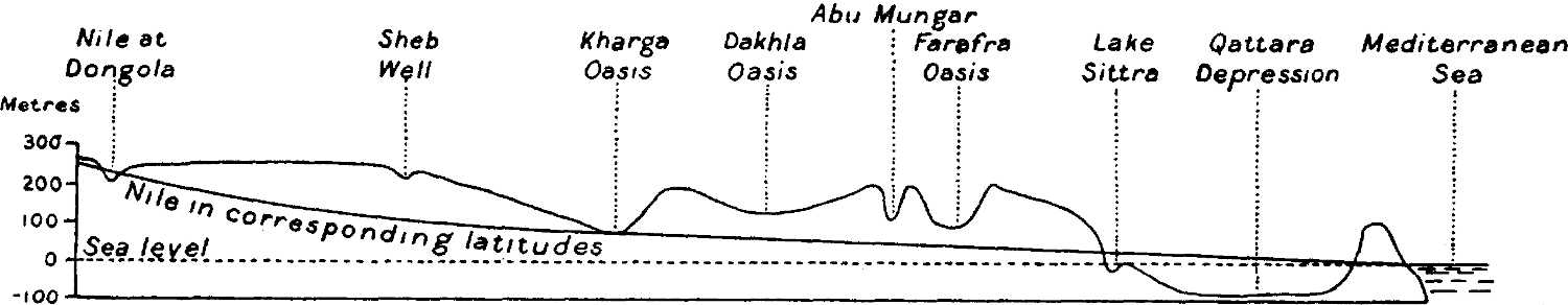
Profile from the Nile at Dongola through the depressions of Kharga, Dakhla, Abu Mungar, Farafra, and Qattara to the Mediterranean. Vertical scale 500 times the horizontal. Total length of section about 1700 kilometres; for more than half this distance the ground-level is seen to be above a line drawn through the levels of the Nile in corresponding latitudes.
Can any one believe that a course of this kind was ever that of a river? To make a through channel would entail deep cutting for more than half the total distance of 1700 kilometres, and would consequently involve excavating hundreds of millions of cubic metres of rock, much of it of considerable hardness. Moreover, it cannot be supposed, in the[32] present state of our knowledge of the region, that more favourable lines of communication exist and have been overlooked. Many depressions doubtless still remain to be discovered; but these, like those already known, will surely prove to be merely local basins. So many cross-country journeys have now been made in various directions through the desert, that it is inconceivable that any continuous channel of the kind we are discussing could possibly have escaped notice. Nor can we reasonably suppose that recent earth-movements have produced the present severance of the various depressions; such movements might perhaps be invoked to account for one or two of the separating elevations, but certainly not for all. We can therefore be absolutely certain that neither the Nile nor any branch of it ever passed through the Libyan Desert to the sea.[11]
Even channels of tributary streams to the Nile, such as abundantly survive in the great wadis which enter the Nile valley on its eastern side, are markedly absent in the Libyan Desert. The contours on the map suggest that possibly one such tributary stream may formerly have drained the south-western faces of the great plateau in which the depressions of Dakhla and Kharga form bays, and have entered the Nile somewhere between Aswan and Halfa; but if such a channel ever did exist, its actual traces have long since been obliterated by the smoothing action of subsequent denudation, and only the great escarpment of the plateau which it half encircled remains to tell the tale.
Photographs by Prince Kemal el Din, Dr. Ball, and Mr. Walpole
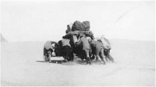
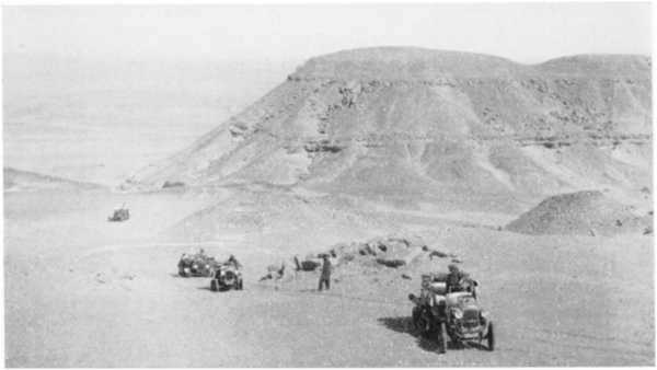
1. Desert exploration with the ordinary car, requiring help even on flat ground in sandy tracts
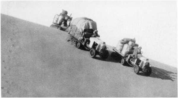
2. Caterpillar cars carrying heavy loads over a sand-dune between Bir Terfawi and Gebel Owenat
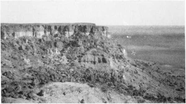
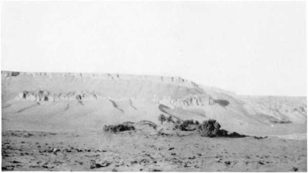
3. The western wall of the Qattara depression 35 km. S.S.W. of Qara Oasis. Top of cliff about 3 m. and floor of depression 133 m. below sea-level
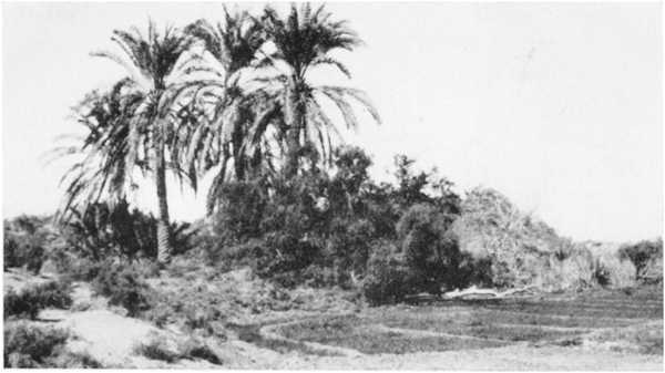
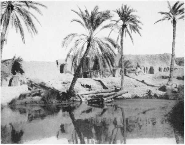
4. Ain el Hez, Baharia Oasis, irrigated by free flow from well
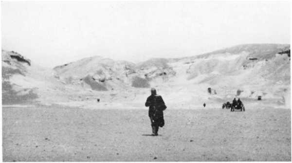
5. Overlooking the Baharia depression from the pass at its southern end: cars bound for Farafra
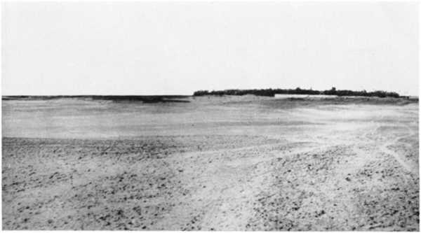
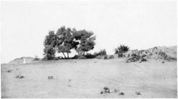
6. Northern end of Farafra depression: sandy ravine cutting back into chalk plateau
2. Origin of the Depressions.
It is a marked characteristic of almost all true deserts, that they are regions of internal drainage; and the Libyan Desert is no exception to the rule. There are a few gullies draining from the plateau to the sea along its northern edge, and a few others draining into the Nile Valley along its eastern border. But none of these external drainage-lines extends for more than an insignificant distance backward into the interior of the country. There is, in fact, in the Libyan Desert (especially in its north-eastern portion) a marked absence of any distinct drainage-lines at all; in their place we find extensive stony plains, which either slope gradually down towards the various inland depressions, or terminate in an abrupt fall where the depressions are cut back into them. Even in the[33] Pluvial epoch, when Europe was glaciated and the deep wadis of the Eastern Desert on either side of the Nile were being cut out by great streams, there cannot have been any external drainage from a large part of the Libyan Desert; for if there had been, we should find the Libyan plateau far more intensely dissected than is actually the case. The rainfall in this region, even during the Pluvial period, must have been far smaller than in the neighbouring tracts of the Eastern Desert and Sinai; such rainfall as did occur was drained into the series of depressions already described, and there either formed lakes or was evaporated. But the action of inflowing drainage waters, carrying sand and mud in suspension and salts in solution, is not to deepen the basins into which they flow, but rather to fill them up. Hence we must look to some other cause for the formation of the basins themselves. A possible cause is to be found in earth-movements—either a local down-folding of the crust, or an upraising by faulting of the surrounding tracts. It is not unlikely that such earth-movements have to some extent conditioned the formation of the depressions; but that the depressions are not simply faulted-down areas or subsidences is abundantly clear from an examination of the bounding scarps and the floors of the larger oases. Baharia is wholly, and Kharga and Dakhla are partially, bounded by high escarpments, in many places hundreds of metres high, and the floors of these oases are composed of the same rocks as are exposed at the base of the bounding escarpments. It is, in fact, obvious that these great hollows are natural excavations, not subsidences. What was the excavating agency?
To the south-west of the limestone plateau which lies west of the Nile and extends northwards from lat. 23° 30′ there is fairly open sandstone country, and the oases of Dakhla and Kharga occupy great bays in the escarpment which marks the south-west termination of the plateau. It seems reasonable to suppose that the Eocene and Cretaceous seas had their southern shores somewhere about the latitude of Wadi Halfa, for the limestones do not extend far beyond the tropic; and to the south the hard limestones of the plateau probably passed gradually into softer shallow-water deposits, which would lend themselves easily to degradation and to removal by the agency of streams whose traces have long since disappeared. We can thus possibly invoke water-action to account for the primitive formation of the “bays” in which Kharga and Dakhla are situated. But we cannot in this way explain either the further deepening of these oases, which converted them into basins, or the excavation of the more northerly depressions such as Baharia and Qattara.
The problem as to how the excavation of the northern depressions, and the deepening of the southern ones, were accomplished is not altogether an easy one. There is, of course, no doubt that wind has been the main excavating agency. All the depressions occur in areas where soft rocks are overlain by hard ones, and once the hard overlying rock was removed[34] at any place, the action of the wind on the softer beds would soon excavate a hollow. The difficulty is only as to how the hard overlying rock was first removed. To some who have studied the question, a sufficient explanation is to be found in the general degradation, combined with the tectonic disturbances—folds and faults—which are known to have affected some of the oasis-areas, as, for instance, that of Baharia. Given an anticlinal fold, a general lowering of the surface by wind-degradation would eventually result in the exposure of the soft underlying beds at the highest point of the fold, and subsequently continued wind-erosion would proceed most rapidly on these soft underlying rocks. Others, while admitting this explanation as partly accounting for the formation of the depressions, consider that other factors must have assisted to cause penetration of the hard overlying beds, especially in the areas where folding is not very marked.
Of such other factors, I can only suggest what appears to me to be a possible one. About twenty years ago I was mapping the Mediterranean coastal area in the neighbourhood of Mersa Matruh, some 160 miles to the west of Alexandria. In this area, which has about 6 inches of rainfall in an average year, there are numerous closed-in basins a few miles long and a few hundred yards in width, descending to a depth of 10 metres or more in the rather soft limestone which forms the principal rock of the locality. These basins, though called wadis on the maps, are more usually known as ’ebs or “bosoms” by the local Arabs. I was at first much puzzled to account for them; but eventually I arrived at what I believe to be the true explanation of their formation. The basins, of course, collect the surrounding rainfall in the winter, and the drainage carries with it into the hollows a certain amount of fine loam and sand from the disintegration of the surrounding surfaces. After the rains, the bottoms of the basins become covered with vegetation, while the surrounding rocky surfaces are left bare. In the hot dry summer, however, the vegetation perishes, and much of the loam is removed by the wind. We have only to assume (what seems indeed likely) that the rootlets of the vegetation disintegrate the limestone floors of the hollows to form fresh soil, and that more of this is removed each year by the wind than is brought into the hollows by the drainage, to find an adequate cause for a slow but progressive deepening of the basins. The primitive hollow may well be a very slight depression of the surface, such as might arise from greater local softness of the rock and consequent more rapid weathering. Once vegetation has commenced to grow in a slight hollow of this kind, the action would lead to a slow yet steadily progressive deepening year by year, and sand-erosion would tend towards an elongation of the depression in the direction of the prevailing wind. Can such a process as this, continued through vast ages during which the climate was somewhat less dry than at present, have been active in the formation of Baharia and similar depressions?
[35]3. The Possibility of Utilization of Depressions in the Libyan Desert for Irrigation, Drainage, or Hydraulic Power.
The depression known as the Wadi Rayan, discovered by Mr. Cope Whitehouse about 1883, situated some 40 kilometres west of the Nile Valley and about 100 kilometres south of the latitude of Cairo, has been so frequently described and considered in regard to its utilization as a reservoir or as a flood-protection for Lower Egypt, that I need say little about it beyond a reference to the principal published works dealing with it.[12] There is no other depression in the Libyan Desert which has received so much attention from the economic standpoint. That the Wadi Rayan has not already been utilized as a reservoir has depended on a variety of considerations, of which one of the principal has been the doubts always entertained as to whether there might not be an underground leakage from it, resulting not only in a loss of part of the stored water, but also in damage to the adjacent flourishing province of the Faiyum. These doubts will not be lessened by the converging lines of evidence which I shall bring forward in dealing with the artesian water-supplies, all leading to the conclusion that there is an underground water-connection between the various depressions of the Egyptian Libyan Desert. Of late years, however, it has been proposed to make use of the Wadi Rayan, not as a reservoir, but as a sump for disposing of the drainage water of Upper Egypt by evaporation; and to this, in consequence of the lower level at which the water would stand in the depression, there is far less objection from the point of view of possible leakage or damage to the Faiyum.
The Wadi Natrun, which, though considerably less deep, is not greatly less in extent than the Wadi Rayan, has received some consideration as a possible sump for disposing of some of the drainage water of the Behera Province of the Delta. So long ago as 1895 the Public Works Department studied the possibility of draining Lake Mariut into the Wadi Natrun, and thus doing away with the increasing cost of keeping down the level of the lake by pumping water from it into the sea.[13] The Wadi Natrun has an area, even at the low contour of 10 metres below sea-level, of nearly 100 square kilometres, and the average rate of evaporation from an open water-surface within it could not well be much less than 3 mm. per day; the wadi could therefore dispose annually of at least 100 million cubic metres of drainage water by evaporation alone, and probably of a considerable additional quantity by seepage. But the[36] high cost of cutting a drainage channel from Lake Mariut to the wadi, and the heavy maintenance charges which would be incurred in keeping the drain open, were formidable objections to the scheme. From a reconnaissance carried out in 1896, Mr. Verschoyle found that the length of the proposed drain would have to be almost 80 kilometres, and for the greater part of the way it would have to be a cutting 20 metres in depth through desert and ridges of drifting sand; he remarked that if it were an easy matter to make the connection, it would be no easy matter to maintain it; and he concluded that the scheme was an impracticable one.[14] A more recent proposal has been to construct a partly tunnelled channel instead of an open drain; but this has likewise been found to be impracticable, as involving too heavy an outlay for the benefits which would result.[15]
7. Qasr Farafra, seen from the north over plain of powdery chalk forming floor of depression
8. Escarpment and “Hattia” of Abu Mungar from the south
9. The “Hattia” of Abu Mungar from the east: well on earth-mound on right
10. The principal well at Qasr Farafra
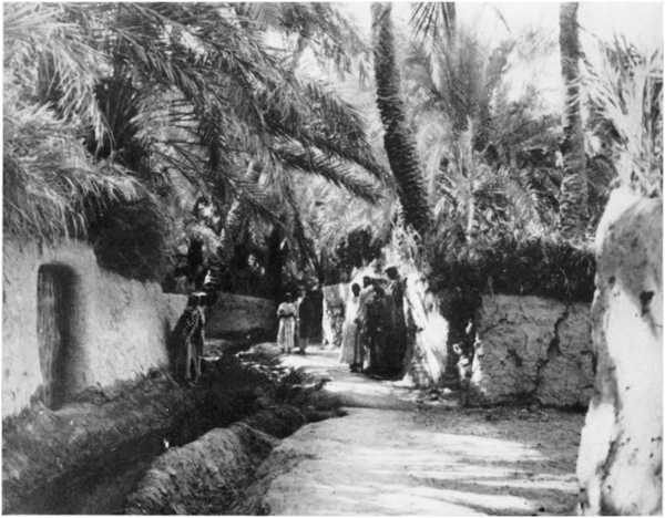
11. A street in Qasr Farafra, with irrigation canal
When the great extent and depth of the Qattara depression were established by Mr. Walpole’s explorations of last year, hopes were immediately entertained that the depression might be made to serve some useful economic purpose. Any idea of its being of use as a Nile reservoir was of course at once cut out, not only by reason of its position and distance from the Nile, but also by its immense size; for even if we could turn the whole Nile flood into it, some twenty years or more would be occupied in filling it to a sufficiently high level,[16] and the loss by evaporation from so large an area would be enormous. As a receptacle for drainage water from the Delta it appeared equally impossible of consideration, because of the great length and depth of the channels which would have to be cut to reach it. A more reasonable prospect seemed to be that of admitting sea-water from the Mediterranean into it by means of a navigable canal from the Arabs Gulf; this would only have to be about 56 kilometres in length to reach the nearest point of the depression; and once the canal was made and the depression filled, ships might sail almost to Siwa. Other advantages which might accrue from the formation of this inland sea were an increased humidity of the climate along the Mediterranean Littoral of Egypt, leading to increased rain-crops in that region, the establishment of a valuable fishery, and a possible increase in the water-supply of the oases by the causing of a[37] slight rise in the static water-level there. Another idea, which rapidly followed the first one, was to utilize the depression as a source of electrical power for driving pumps by which the drainage of the northern parts of the Nile Delta might be improved. At first sight this latter prospect looked a very attractive one. The salt-marsh which covers much of the floor of the depression appeared suggestive of a former sea-connection, and if we could trace out this old connection, the cutting of a canal along it might not, it was thought, be a very expensive matter. Moreover, it was apparent that evaporation from an inland sea or lake of so large an area would keep pace with quite a large influx from the Mediterranean, so that if the influx were restricted to such a quantity as would permit of the lake-surface being maintained at a level considerably below that of the Mediterranean, power could be generated continuously. Suppose, for instance, that we maintained a permanent water-level in the lake of 50 metres below the sea; the estimated area of the lake at this level being 9000 square kilometres and the mean evaporation assumed to be 4 millimetres a day, an influx of no less than 36 million cubic metres of water per day could be passed into the lake without altering its level, and this with a fall of 50 metres would suffice theoretically for the continuous generation of over 270,000 horse-power. Of course the lake would gradually get more and more saline, but the power might continue to be maintained for very many years before the lake became as rich in salt as the Dead Sea.
But alas! an investigation of the northern borders of the depression showed that the hoped-for traces of a former connection with the Mediterranean Sea do not exist. The depression is entirely shut in from the north, either by great cliffs, or by ground lying so high that the cutting of a canal to the sea is utterly impracticable. Of the 56½ kilometres from the sea-level contour of the depression to the coast along a line running 12° east of north from Moghara Lake (which is the easiest line hitherto found for the cutting of a canal), only 16 kilometres are at less than 50 metres above sea; 31 kilometres lie at altitudes between 50 and 100 metres; and 9½ kilometres are above the 100-metre level. An open channel being thus put out of the question, it was next natural to inquire whether a tunnel, or a channel partly open and partly tunnelled, could be excavated to serve for the conveyance of sea-water into the depression. But even this, though perhaps not impracticable, would be a very costly undertaking. The conveyance of the requisite quantity of water, even at a relatively high velocity (which of course implies a considerable slope), would necessitate a tunnel or tunnels of very large dimensions. To convey 36 million cubic metres a day at a velocity of 5 kilometres per hour would require a sectional area of 300 square metres—i.e. if two tunnels were made, each would have to be 14 metres in diameter. The cost of boring and lining such tunnels would certainly be very great, and it is doubtful whether the value of the power generated could justify the capital expenditure[38] involved in the excavation and other works which would be necessary. Until more is known of the nature of the strata through which the aqueduct would have to pass, and as to the length of tunnelling and amount of open cutting which would be required, it is impossible to form even an approximate estimate of the expense which the undertaking would involve. All that can be said at present is that the utilization of the Qattara Depression offers a possible means of obtaining power on a large scale for the drainage of the low-lying lands of the Delta, with at the same time a prospect of improving in some measure the agricultural resources of the Mediterranean Littoral; much further investigation will have to be accomplished before any judgment can be formed as to whether such a project would be an economically sound one.
In formulating any scheme for improving the drainage of the Delta, it is of course important to consider, not only the manner in which the drainage water could be ultimately disposed of, but also the modifications which would have to be made in the existing drains and irrigation canals—modifications which would need to be carried out without serious interruption to existing agriculture. A scheme which otherwise appeared attractive might easily prove to be impracticable by reason of the heavy expenses and inconveniences of the subsidiary works which would be required to make it effective.
THE LIBYAN DESERT
Showing Surface-Relief, Contours of Static Underground
Water-levels,
Distribution of Sand-dunes, and Routes of Principal Exploratory
Expeditions in the West and South
by
Dr. JOHN BALL
THE GEOGRAPHICAL JOURNAL JULY 1927
[No. 2
105]4. The Artesian Water
Supplies.
The origin of the artesian water supplies of the Egyptian oases of Baharia, Kharga, Dakhla, and Farafra (Siwa seems hitherto generally to have been left out of consideration) has been a much-discussed question. Some geologists, myself amongst them, have always regarded the water as being derived from rainfall in the western Sudan, flowing underground in permeable beds towards the Mediterranean. Others have held the view that the oasis waters are merely Nile water which has penetrated more or less laterally into the adjoining deserts. The arguments that have been urged in support of the former view are, firstly, the high temperature of the water in many of the oasis wells; and, secondly, that the levels of the springs and wells are often much higher than those of the Nile in the same latitudes. To these arguments it has been justly replied that neither of them is conclusive; the high temperature of the outflowing water merely testifies that it has descended to considerable depths at some part of its underground path not very remote from the point of outflow, but really tells us nothing as to its place of origin; and the high level of the springs in Baharia, for instance, as compared with that of the Nile in the same latitude, might be accounted for by the seepage from the Nile taking place fairly high up in the river’s course. There the question remained until 1925, when I was able to visit and determine the positions and levels of a number of water-sources farther in the interior than any of those on which the “Nile” argument was based. Amongst other level-determinations, I ascertained that the Sheb well is 228 metres above sea-level, and that Merga Lake, lying far to the south-west (in lat. 19° 3′, long. 26° 18′), is at an altitude of no less than 509 metres above the sea. Shortly before my tour in the Sudan, Hassanein Bey had confirmed Rohlfs’ level of 400 metres for the Kufra water-sources, and I had found that of Abu Mungar (north-west of Dakhla Oasis) to be 117 metres. At all these places the water-supplies are derived from underground sources in the same rock—namely, the Nubian sandstone, which covers such vast areas in the Sudan and Egypt.
I had thus four well-determined natural water-levels at the corners of a great quadrilateral whose sides averaged over 500 kilometres in length, and embraced more than 20 square degrees of the Earth’s surface. Now just as in solid geometry the levels of any three points determine the inclination of an oblique plane to the horizontal, so on the Earth any three levels will determine the inclination of a surface to the geoid (of course assuming both geoid and surface to have the same curvature).[106] And on making the calculation, I found that I obtained practically the same degree and direction of inclination for the natural water-surface, whichever three of the four known points I utilized for the calculation. In other words, I found that if I took, say, the levels of Kufra, Abu Mungar, and Sheb, and deduced from them the inclination of the water-surface to the horizontal, I could calculate the level of Merga pretty exactly. Extending the trial, I found that I could do the same with a fairly close approximation for the other wells in the Sheb neighbourhood, and also for wells in the oases of Dakhla and Kharga. The conclusion seemed irresistible that all the wells considered were fed from a continuous sheet of underground water; and it was evident that this water did not come from the Nile, firstly because of the high level of Merga, which is above that of the swamps of the Bahr el Ghazal and other western feeders of the White Nile, and secondly because of the direction of the downward slope of the underground static water-surface, which is from the south-west, instead of from the south as it would have been had the water been derived from the Nile in the Bahr el Ghazal region. The true source of the water must be somewhere more or less nearly on a line drawn south-west from Dakhla, for this is the direction of upward slope of the underground static water-surface; and if such a line be drawn on a map of Africa, it will be found to lead towards the Erdi and Ennedi region, on the borders of the Chad basin. It is in the highlands of Eastern Erdi and Ennedi, therefore, that we must look for the source of the artesian water of the Egyptian oases. What is known of this region from the recent explorations of Colonel Tilho lends good support to our conclusion.[17] It is a bare and rugged sandstone country, where, in spite of a rainfall which is by no means negligible, permanent water-sources are scanty, and where, in consequence, there must be a considerable absorption of moisture by the rocks; and it lies at so high an altitude as to give sufficient “head” for the absorbed water to percolate through the porous sandstones and thus to reach Egypt.
Being convinced that I had at last arrived at the true origin of the artesian water, I next began to entertain the idea of attempting to make a map which would show the contours of the underground water-sheet, and from which, in conjunction with the contour-map of the surface which I had already prepared, I might be able to predict the depth of boring required to tap the underground water at any point in the desert. But a little consideration showed that this idea was an impracticable one, by reason of our ignorance of the underground geological structure over the greater part of the desert. The underground water would naturally pass along permeable sandstone beds, often confined between impermeable clays above and below. And although the general structure of the Libyan Desert is doubtless one of simplicity as compared with that of other parts of Egypt, yet we know, from observations in the oases and[107] in the Owenat region, that the beds are in some places folded and faulted, and that in others they have been uplifted and entirely removed by denudation, with the exposure of large areas of the underlying ancient crystalline rocks. The only parts of the desert for which the boring-depths could safely be predicted would be certain small areas within the oases, where wells have been sunk in sufficient numbers to give us definite information as to the local underground structure; and underground-water maps of these small areas, though they might usefully systematize our knowledge concerning them, would not be of any use for predictions at points situated elsewhere in the deserts.
But while it was thus impracticable to prepare maps showing everywhere the depth at which underground water actually exists, I conceived that it might be quite possible to prepare maps showing static water-levels; that is, the levels to which the water would anywhere rise hydrostatically when once it was tapped by borings. For the slope of the static water-surface between known points will be largely independent of the underground structure of the intervening country. Apart from any physical changes which may still be going on in the underground rocks themselves through geological agencies—changes which, if taking place at all, must be so slow as to be negligible except in the course of centuries—the only factors which can affect the slope of the static water-surface, once it has been established, are variations either in the rate of supply of water to the beds, or in the rate at which it is removed from them. As regards variations in the rate of supply, it is obvious that variations in the annual rainfall of the Erdi and Ennedi region must cause very considerable variations from year to year in the amount of water received by the underground beds. But the resistance of friction to the flow of water through the pores of the sandstones is so great, that the annual oscillations of pressure must be rapidly damped out as the distance from the place of influx increases; consequently the levels of the water in the wells of the Egyptian oases (and even, so far as is known, that of the lake at Merga) show little or no annual variation. And with regard to variations in the rate of removal of water from the beds (by outflow to the Nile, or to the sea, or into lakes wherein it evaporates, or by the exploitation of wells and springs for irrigation purposes), these changes, though possibly in some cases they may be progressive, and in restricted localities very sensible, can exercise but little influence from year to year on the general distribution of water-pressure within the underground strata. We may therefore conclude that the gradient of the static water-surface will everywhere have assumed practically a steady state. Unlike the actual water bearing beds themselves, which may be much folded, the static water-surface will in general have simple gentle slopes everywhere in the open desert. In the oases, of course, where numbers of wells yielding large outputs have been bored in proximity to each other, the static water surface will be wrinkled; but over the vast bulk of the desert the[108] contours may be expected to be smooth curves. The diagrammatic section below will, I think, make clear this point about the general non-dependence of the shape of the static water-surface on the geological structure:
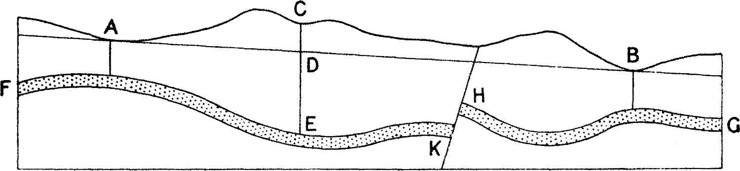
Diagrammatic section showing that the static water-level is largely independent of the underground structure
In the diagram, FEKHG represents a water-conveying stratum, folded throughout its course and faulted at HK, but having a general downward slope from F to G. A and B represent points at which the water just rises to the ground-level, either through natural fissures or in artificial borings. The straight line drawn through A and B represents very approximately the static level at any point between A and B, that is, the level to which the water would rise in bores carried down to the water-bearing bed. A boring at C, for instance, would have to go down to E to tap the water, but once the bed was tapped the water would rise in the bore as far as D. At the fault HK, the pressure of the water at K will cause it to rise through the crushed rock at the fault-plane and re-enter the porous stratum at H. If there is a considerable outflow at B, and the fault-plane is a very narrow fissure, we may expect some drop in the line AB over the fault, by reason of the extra frictional absorption of head at this place. But unless the thickness and degree of permeability of the fault-rock are markedly different from those of the sandstone bed itself, the drop of pressure will not greatly disturb the general slope AB. In any case it is apparent that the level of the static water-surface at any place between A and B is capable of being estimated with a far closer degree of approximation than is the level of the water-sheet itself. We may therefore justifiably assume a uniform gradient for the static level between points at which that level is known, disregarding folds in the strata; and though we cannot entirely allow in detail for unknown faults and variations in permeability, it must be borne in mind that the total effect of all the unknown factors between any two known points is already automatically allowed for in our data. It is only the variations from uniformity, due to the unknown distribution of the faults and of the departures from the average permeability, which can affect us; and these variations and departures are probably but small in most of the great unexplored areas of the south-west of Egypt, where the geological structure, from all we know of it, appears generally to be remarkably uniform.
The first requisite for the construction of a map showing the contours of the static water-surface was, of course, a sufficiency of well-determined[109] positions of points where the static water-level of the artesian supply was fairly exactly known. Such points are the springs and wells of the various oases, the surfaces of lakes occupying depressions and presumably fed by underground supplies, and any places on the Nile where the river taps artesian beds.
In regard to the wells and springs, it was obvious that only those known to derive their supplies from artesian sources could be utilized as giving points on the static water-surface. This consideration cut out from the discussion the springs of Owenat and Arkenu, which are known to be fed by local rainfall, and also the small water-sources of Kurkur, Dungul, Nakheil, and Ain Amur, which occur in situations where percolation from occasional local rainfall seems to be the only possible source of supply. And for reasons which will appear presently, none of the wells and springs situated to the north of the Siwa-Qattara-Faiyum chain of depressions could be considered as entering into the problem. With these exceptions, every water-source situated within the area of the Libyan Desert covered by the map, and whose level was known, was utilized; but in the greater oases and in the Wadi Natrun the wells and springs are so numerous and so close together that in these localities it was necessary to select one or two wells as representatives of a group. I had no hesitation in including the wells of Siwa and the Wadi Natrun, because the temperature of some of the wells and springs of Siwa, and the quantity of the output of water at both places, seem to me to afford conclusive evidence of the artesian character of their supply.[18] The wells of the little oasis of Lageita, to the east of the Nile near Qena, were included, for although they are not in the Libyan Desert, they most probably derive their supplies from the same underground flow which feeds the western oases. I have included only one well in which the water does not rise nearly to the ground-level. That well is one which was bored by the British Army during the Great War, at a place called B6, some 40 kilometres to the east of Baharia Oasis. The level of the ground at this point is 112 metres above sea-level, and as the water was stationary in the bore at 78 metres below the ground, the static level here is 34 metres above sea.[19] The well is said to have yielded some 800 gallons per hour without the water-level in the bore being sensibly changed.
The level of the well at Sarra has recently been determined by Prince[110] Kemal el Din; but I have not included it in my data, because he informs me that the water-level fluctuates by 20 metres or more in different years, while the level of the artesian water of the Egyptian oases and Merga is very nearly constant. The inference I draw from the great fluctuations in the water-level at the Sarra well is that it is dependent on percolation from a more or less local rainfall rather than on the same flow which feeds the Egyptian oases.
5. Permanence of Lakes.
In regard to lakes and salt-marshes, the permanence of those occupying the depressions of Areg, Bahrein, Sittra, and Qattara can only, I think, be adequately explained by regarding them as fed, at least in part, by underground supplies coming into them from the south. The total area of the lakes of Bahrein, Nuemisa, Sittra, and Moghara is nearly 20 square kilometres, and that of the salt-marshes (sabakha) is not less than 5000 square kilometres. The depressions are situated in a region which is nearly rainless; in Siwa the mean annual rainfall is only about a quarter of an inch, and that in the depressions farther south, such as Bahrein and Sittra, is doubtless even smaller. The mean daily evaporation from the lake-surfaces cannot well be less than some 4 mm., which would mean a lowering of the lake-levels by evaporation of 1½ metres each year unless there was some inflow to make up for the loss. And though the rate of evaporation from the salt-marshes, area for area, is doubtless very much smaller than that of the lakes, the 250-fold greater extent of the marshes makes it certain that the total quantity of water annually evaporated from them must far exceed that from the lakes.
It appears unlikely that the loss by evaporation in the lakes and marshes can be entirely made up from local rainfall and by seepages from the northern slopes. The rocks forming the surface of the great Miocene plateau, 200 metres high, which separates the depressions from the sea, are chiefly limestones and clays; the beds are nearly horizontal, but such slight dips as exist are believed to be towards the sea. The average annual rainfall on the coastal portion of the plateau is about 6 inches; but it falls off rapidly inland, till it is only about a quarter of an inch near Siwa. The heaviest rainfall on the plateau thus occurs along a strip parallel to the coast, where it is largely drained off towards the sea by the gullies which indent the plateau-edge. Of that which falls on the plateau-surface farther inland comparatively little is absorbed, owing to the generally non-porous nature of the uppermost rocks; after a heavy shower, water lies on the surface in shallow pools for a few days and is soon evaporated. So impervious to water is the limestone in this region, that the Romans excavated chambers in it to form reservoirs, of which many hundreds still exist. Nor can we think that much surface drainage-water from the country to the south ever finds its way into the depressions; for there is an almost complete absence of drainage-lines entering them.[111] At the feet of the northern scarps of the Qattara depression, and along the north-eastern shores of the lakes in the Wadi Natrun, there are, indeed, small springs which show that some of the rain falling on the plateau does actually penetrate the rocks and escape by seepage into the depressions. But the amount of this seepage appears to be insignificant compared with the volume of water which must annually disappear from the lakes and marshes by evaporation. A further consideration bearing on this point is that whatever may have been the agency by which the depression of Siwa was formed, that same agency almost certainly operated to produce the other depressions of the northern chain; and it seems most unlikely that a connection should have been opened up with the underground water-bearing beds in Siwa, and not also in the larger and much deeper depression of Qattara.
It would be a difficult matter to estimate the relative proportion of the water entering the depressions by underground flow from the south, to that contributed by local rainfall and seepage from the northern slopes. But that is not necessary for our immediate purpose. It is sufficient to show that there must be some influx into the depressions from the same source as that which supplies the wells of the greater oases, to establish the existence of that underground water-connection which is all that we need to justify us in regarding the levels of the lakes and salt-marshes as furnishing us with points on the static water-surface; and from the considerations mentioned above it seems to me certain that some influx of underground water really does take place.
I have also thought it justifiable to include the Birket el Qarun in my collection of static water-level data, because although that lake was probably first formed by an overflow of the Nile into the Faiyum, and is even now being fed by Nile water through the Faiyum drains at the rate of some 350 million tons a year, there is a certain amount of evidence suggesting that it has some underground water-connection with the Qattara depression. That evidence, to which attention was first drawn by Professor Schweinfurth,[20] consists in the relatively low salinity (1·3 per cent.) of the lake, notwithstanding the long period through which it has been subject to evaporation and the fact of its having shrunk to dimensions very much smaller than it possessed in ancient times. Unless there has been a large underground efflux of salt water from the lake, it appears impossible to account for its present degree of freshness. In Professor Schweinfurth’s day, of course, the existence of the Qattara depression was unknown, and it was puzzling to suggest where the salt water had gone to.[21] An underground leakage from the Birket el Qarun into the Qattara depression is quite conceivable, for although the two places are[112] separated by some 200 kilometres, there is a very considerable fall between them. Thus the salt in the marshes of the Qattara depression may possibly have come in part from the Birket el Qarun. The present rate of discharge of the Faiyum drains into the lake is, however, just sufficient to make up for an average daily evaporation from the lake-surface of a little over 4 mm., which is about the rate we might expect; and although the level of the lake-surface has fallen some 5 metres since observations of it were first made in 1886, it is now nearly stationary; hence it does not appear likely that there is much underground leakage at present. If the former leakage from the lake took place by lateral flow into porous strata near its surface, of course the leakage may have been arrested by the lowering of the lake-level uncovering the porous beds into which it took place; but I think a more likely explanation is that the leakage occurred at or near the bed of the lake, and has gradually been reduced by the continued deposition of Nile mud on the lake-bottom, and by the diminution of head due to the fall in the water-level.
In regard to the tapping of the artesian waters by the Nile, there is only one locality in which this is known to take place; but the quantity of underground water which is there withdrawn by the river is probably very considerable. When I was surveying the Nile Valley between Aswan and Korosko in December 1898, I observed that in the vicinity of the temple of Dakka (about 105 kilometres south of Aswan) the lands on the west bank of the river were being irrigated with warm water, drawn by “sakias” (water-raising machines) from pits sunk in the alluvial flat which extends between the river and the edge of the sandstone desert. The length of the tract over which the warm water was being withdrawn for irrigation was found to be about 16 kilometres, stretching from 2 kilometres north of Dakka temple southwards to the temple of Maharraga; and the width of the alluvial tract at Dakka, where it is widest, was about 1300 metres. Some of the water-pits were more than a kilometre from the river. Levelling from the Nile (the surface of which was then about 99 metres above sea) across the cultivation to one of the sakia-pits 750 metres west of the river, I found the level of the ground at the sakia-pit to be 7·9 metres above that of the Nile, and the water-surface in the pit to be 8·4 metres below the ground-level; there was 1·2 metres depth of water in the pit. The temperature of the water in the pit I found to be 83° F., while that of the Nile was 60° F. and that of the air was 67° F. The headman of Dakka told me that the exploitation of this warm underground water had begun about 1887; they dig out the sandy mud, and then see the water oozing rapidly into the pit out of the sandstone below. On crossing to the east bank of the river, I found that there also the warm water was being similarly raised for irrigation, though to a smaller extent, because on that side the sandstone desert approaches more closely to the river and there is much less cultivable land. The exploitation of the water on the east side of the Nile extended only over[113] a distance of about 5 kilometres along the bank, with a maximum width of alluvial plain of 600 metres, just at the place where the great Wadi Alagi debouches into the Nile Valley. As the sandstone bed from which the warm water issues is less than 2 metres below the level of the water-surface of the Nile, and the water occurs on both sides of the river, it is certain that the water-bearing bed is cut through by the Nile channel itself; the seepage into the river along the stretch of 16 kilometres must therefore be very considerable. It seems evident that the water is not derived from the bed of the Wadi Alagi, great drainage-channel though that wadi is; for we could not then account for the temperature of the water, nor for its appearing to a larger extent on the west bank than on the east, with the river in between. Moreover, the water appeared to be much more free from salts than we should expect it to be if it were merely drainage from the Wadi Alagi. It strongly resembles, in fact, both in temperature and character, the artesian water of the greater oases, and there can hardly be the smallest doubt that at Dakka the Nile is not only continually abstracting artesian water from the same underground water-sheet that feeds the oases, but is abstracting it in far larger quantities than those yielded by all the oasis wells and springs put together.[22] It is certainly remarkable that the place where considerable supplies of warm underground water enter the Nile should coincide with the embouchure of what is perhaps the greatest drainage channel of the Eastern Desert of Egypt; but I think it is likely that the explanation of the coincidence may be a tectonic one; the water-bearing beds may have been brought up by a local fold in the strata, and the same fold may in some way have conditioned the formation of the primitive drainage-line which was ultimately to become the Wadi Alagi.
Having now indicated briefly the grounds for their acceptance, I give below a table showing the various points which I have adopted as furnishing data for constructing the contours of the static water-surface underlying the Libyan Desert, together with the altitudes of the points above or below sea, and the sources of these level-data. The levels are doubtless in some cases slightly inaccurate; but a few metres of error are immaterial to the object in view, and it is believed that even those levels which rest on barometric determinations are sufficiently accurate for our purpose.
| [114]List of Adopted Points on the Static Water-Surface | ||
|---|---|---|
| Place. | Level (metres). | Determined by. |
| Wadi Natrun, surface of lakes | − 23 | Ball, Trigonometric levelling, 1914. |
| Birket el Qarun, surface of lake | − 45 | Survey of Egypt, 1926. Based on spirit levelling from Alexandria. |
| Moghara, surface of lake | − 23 | Walpole, Trigonometric levelling, 1924. |
| Qattara Depression, various points on salt-marsh, the lowest being | − 80[23] | „ „ „ |
| Sittra, surface of lake | − 16 | „ „ „ |
| Areg, surface of lake | − 25 | „ „ „ |
| Siwa | − 17 | „ „ „ |
| Jaghbub | + 32 | Hassanein, Barometric observations, 1923. |
| Jalo | + 61 | „ „ „ |
| Bir Butaffal | + 98 | „ „ „ |
| El Harrash | + 310 | „ „ „ |
| Awadel (Kufra Oasis) | + 434 | „ „ „ |
| Ezeila (Kufra Oasis) | + 389 | „ „ „ |
| Bawitti (Baharia Oasis) | + 129 | Ball, 1917, and Walpole, 1924. Trigonometric levelling. |
| El Hez (Baharia Oasis) | + 134 | „ „ „ |
| B6 Well (water surface in) | + 34 | Walpole, Trigonometric levelling, 1924, and military records of depth, 1916. |
| Lageita (Eastern Desert) | + 121 | Murray, Trigonometric levelling, 1921. |
| Farafra | + 90 | Ball, Barometric observations, 1924. |
| Abu Mungar | + 117 | „ „ „ |
| Mut (Dakhla Oasis) | + 119 | „ „ „ |
| Kharga (average of numerous wells) | + 70 | Beadnell, Spirit levelling, 1909. |
| Ain Ismail (Kharga Oasis) | + 67 | Ball, Barometric observations, 1925. |
| Bir Murr | + 156 | „ „ „ |
| Bir Abu Hussein | + 182 | „ „ „ |
| Bir Kassaba | + 176 | „ „ „ |
| Sheb Well | + 228 | „ „ „ |
| Safsaf | + 230 | „ „ „ |
| Bir Terfawi | + 244 | „ „ „ |
| Merga, surface of lake | + 509 | „ „ „ |
| Dakka, water-surface in wells | + 99 | Ball, Spirit levelling from the Nile, 1898. |
To prepare a map showing the contours of the static water-surface, I took a graticuled sheet and plotted the above-scheduled points on it in their ascertained geographical positions, affixing the adopted level to each. To get points on the various contours at vertical intervals of 100 metres, I joined each pair of points on the map by a pencil line, and then, by interpolation from the terminal levels, found the points on this line[115] where the various contours crossed it, on the assumption of a uniform gradient between the terminal points. Many of the lines thus drawn of course crossed each other, so that interpolation of the static level at the point of their intersection gave two values for the same place. But their agreement was wonderfully close, considering the fewness and the scattered nature of the datum-points, and this went a long way to encourage me in the belief that the hypothesis on which I had been working, namely, that of an underground water-connection between all the points included in my list, was correct. I found that the contours of the static water-surface could be approximately represented by a series of smooth curves, as shown (on a reduced scale) in the outline map below.
Apart from the general smoothness of the curves, especially in the south-west, where it may in part be due to the scantiness of control-points, the most striking thing on this outline map is the north-eastward projection of the 100-metre static contour, where it runs out so as to include Baharia Oasis. The reasons for this projection are obviously the efflux of water, on the one hand north-westwards into the great Qattara depression, and on the other hand into the Nile at Dakka. The indentation of the 400-metre contour near Kufra is likewise explained by the withdrawal of water from the wells of that oasis. The general parallelism of the curves in the south-western part of the map, showing a gradual rise in a south-westerly direction towards the Erdi and Ennedi country (which, as I have already stated, is the most probable source of the underground water) is strikingly apparent. I have not been able to extend the contours far to the east and west of Merga, for lack of control-points. It is much to be hoped that some future traveller will determine the water-levels at Selima and Lagia, which would enable the static contours to be extended into the region between Merga and Dongola; provided, of course, that an examination of the water-sources at these places proves their supplies to be artesian.
The most effective way of testing any working hypothesis in natural science being the prediction of hitherto unobserved facts, I venture to forecast that if, as is most likely, the water-sources of Selima and Lagia are artesian, their levels when eventually determined will not be found to differ very much from 270 and 390 metres above sea respectively. These are the approximate levels deduced by prolonging the static water-contours of my maps into the localities of these wells, assuming the contours to continue as smooth curves.
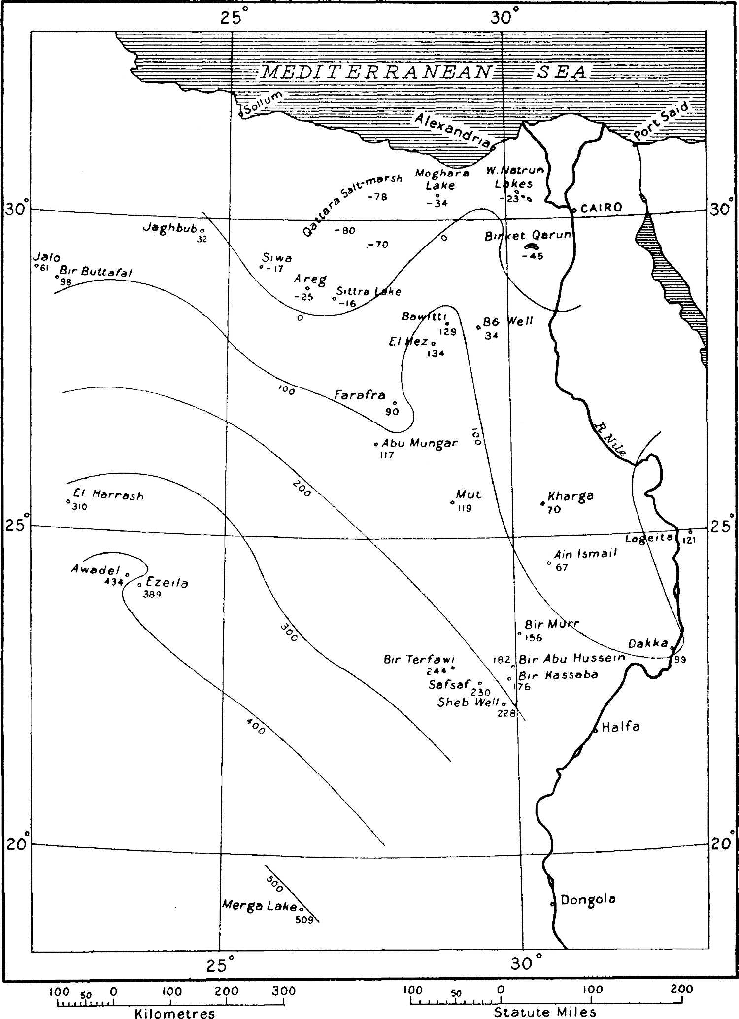
Outline map of the Libyan Desert, showing the points where the static water-levels are known, and the deduced contours of the underground static water-surface, on the hypothesis of a continuous hydraulic connection between the points
Another interesting prognostication which I think may fairly be deduced from the map is that if ever the well at Sarra is considerably deepened, a much more abundant water-supply will probably be obtainable. The ground-level at Sarra, according to observations made by Prince Kemal el Din, is 461 metres above sea, and the water-level in the well varies in different years from about 390 to about 410 metres above sea. But an examination of the static contours of the map shows that[116] the static level of the true artesian water in the neighbourhood of the well is probably somewhere about 500 metres above sea, though an exact estimation of the static level at that spot is not possible because of the lack of data farther west. As already remarked on p. 110, I think the[117] present supply at Sarra is derived from more or less local rainfall, conveyed by higher-lying permeable strata than those which convey the main artesian supplies of Kufra and the Egyptian oases; by deepening the well considerably, lower-lying beds might be reached so as to tap the main supply, and the water might even be expected to overflow at the surface.
Interesting as are the static water-level contours in themselves, they become vastly more so when superposed on the ground-contours, as is done in the larger map (G.J., July, following p. 96). From the two sets of contours on that map we can estimate at any point the approximate depth of the static water-level below the ground; and this information affords new light on some of the most interesting, but hitherto the most difficult, of the problems connected with the Libyan Desert.
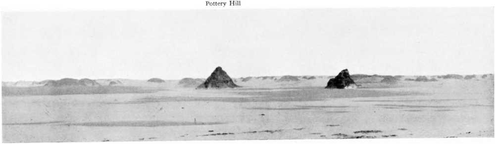
Pottery Hill, possible site of “Zerzura,” from the south-west
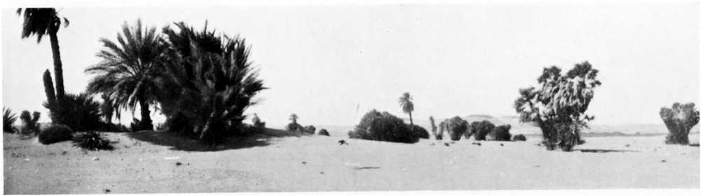
Bir Kassaba, a watering-place on the Darb el Arba’in
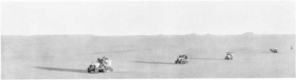
The waterless stretch of the Darb el Arba’in between Bir Murr and Kharga
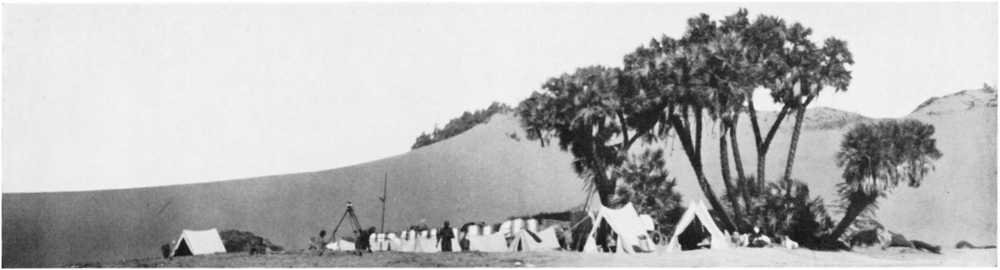
Bir Sheb, a well on the Darb el Ar ba’in
6. Can the Present Water-supplies of the Mediterranean Littoral be supplemented by Artesian Borings?
The present water-supplies of the Egyptian portion of the Mediterranean littoral, derived mainly from shallow wells dependent on the local rainfall, are neither very abundant nor of very good quality. At one or two of the most important settlements along the coast, such as Matruh and Sollum, attempts have been made to improve the supplies by sinking wells to a considerable depth in situations where it appeared likely that the drainage from the inland plateau would be specially abundant. But these have met with little success; the yield has been found to be very moderate in quantity, and of poor quality owing to dissolved salts. The question has often been raised as to whether very deep borings, carried down right through the Tertiary strata and into the Nubian sandstone, might result in the procuring of an artesian supply of the same excellent water as occurs in the oases. Hitherto it has not been possible to give a definite answer to this question, and geologists have been reluctant to recommend deep borings, which would entail great expense, without feeling some assurance that they would be successful. The depth to the Nubian sandstone is unknown, but is certainly great; and if borings were carried down into the sandstone, it was not known whether the water would rise to anything like the ground-level. From our new map, however, we obtain a very decisive verdict on the matter. The Nubian sandstone, even if reached, would not be found to be charged with artesian water under anything like the pressure that it is in the oases; leakage into the Qattara and other depressions will have depleted the beds of much of the water coming from the south-west, and will have lowered the static head to such an extent, that the water left in the sandstone will have too little pressure to rise far into the bores. Any idea of sinking deep artesian wells along the coast to tap the Nubian sandstone can consequently be definitely abandoned. We are driven to the conclusion that in any attempt to improve the local water-supplies of the[118] littoral settlements, we can count only on local rainfall for our primary source, and we must do our best to collect the run-off before it has had an opportunity to absorb much salt. The Romans evidently understood this when they excavated the large rock-cisterns on the plateau, of which there are hundreds. We cannot do better than imitate their example, and arrange for the collection and storage of a sufficient volume of rainwater as it runs from the rocky surface of the plateau. We may do this by restoring to use the old reservoirs; or we might possibly achieve our end by damming some of the rocky gullies which bring down the run-off from the plateau to the plain. Now that the artesian idea is shown to be out of the question, there is justification for a thorough investigation as to the best method of collecting and conserving the local rainfall.
7. Are the Artesian Water Supplies of the Oases diminishing?
The native cultivators in certain parts of Kharga and Dakhla have for some years past found that their wells no longer discharge at so high a level as formerly, and in consequence some of their land has gone out of cultivation. From this fact, and from the evidence of the former greater prosperity of the oases which is afforded by the various ruins of temples, forts, and villages, by the large areas of formerly cultivated lands, and by numerous sanded-up wells, it has sometimes been inferred that the total yield of the oasis-wells is now but a fraction of what it formerly was. But, as Mr. Beadnell has pointed out,[24] the remains of the past which exist in the oases belong to successive generations, so that we cannot fairly draw such a conclusion from them; and the reduction or cessation of the discharge of certain wells does not necessarily imply any falling-off in the total water-output of the oases. Mr. Beadnell’s experiments on flowing wells in Kharga have clearly shown how the opening of a new well at a slightly lower level will affect the discharge of an old well, even one at a distance of a kilometre or more, by lowering the static head in its vicinity.[25] And since a large number of wells have been bored in recent years both in Kharga and Dakhla, it is most likely that the discharge from these wells has caused a falling-off in the yield of older ones situated at slightly higher levels. In this connection it will be well to note that it is not the mere existence of a new well that affects the static head, but the discharge from it. If the new well is securely closed so as to discharge nothing, it has then no effect on the static head and therefore none on the neighbouring wells. But for this to hold, it is important that the well which is closed should be closed throughout its entire depth; it is not sufficient merely to close its mouth so that it does not discharge any water on to the ground, for there may still be rapid leakage somewhere in the bore (unless effectively cased) into porous unsaturated underground[119] strata. Owing to the rapid rate at which iron pipes are corroded in the wells of the oases, leakage of this kind is more likely to happen with an abandoned modern well cased with iron piping and plugged near the top, than with old wells which were filled up with clay and sand. These factors, the mutual interference of wells and the importance of preventing underground leakage, especially from abandoned wells, being now thoroughly understood, steps are being taken towards ensuring that future sites for new wells shall be judiciously selected, and that leakage and waste from abandoned wells shall be as far as possible arrested.
The method of carrying out measurements of well-discharges in the oases is so inaccurate, and the records of the past output so defective, that it is not possible to gather from them whether the total yield of artesian water is at present diminishing or not. Mr. Beadnell considers it likely, however, that the general average water-pressure in the oases has been very much reduced within the historical period, owing to the long-continued exploitation of the artesian supplies.[26] The general study of the Libyan Desert which I have made in the last few years suggests that a gradual reduction in the static water-pressure in the oases may possibly have been brought about by other agencies than the exploitation of the water in the oases themselves.
The first and most important of these other agencies is the withdrawal of artesian water by the Nile in the neighbourhood of Dakka. As mentioned on p. 113, it is practically certain that sandstone beds carrying artesian water are cut through by the Nile along a distance of several kilometres in that locality, and the influx of artesian water into the Nile may far transcend in quantity that removed by the wells and springs of the oases. The Nile has probably deepened its channel in this region by a few metres within historical times, and thus cut through a greater section of the water-bearing beds. An increase in the sectional area of the beds cut through would naturally mean an increase in the quantity of artesian water passing into the Nile, and hence a lowering of the static water-surface extending perhaps to the oases.
The second possible other cause operating to diminish the static head of the artesian water of the oases is the progressive desiccation of a lake which may once have occupied a part of the Qattara depression. As mentioned on p. 110, the floor of this great depression, large areas of which are 80 metres and more below sea-level, is partly covered by a salt-marsh, which is so soft and watery that it can only be crossed at a few places. The hundreds of great water-cisterns cut in the limestones of the plateau to the north of the depression—cisterns most of which are now dry—as well as other ruins along the coast indicative of a considerable former population, seem to show that the rainfall in the littoral region has within the historical period been greater than it is at the present day. When the rainfall in the coastal region was greater, there must have been[120] more drainage into the Qattara depression, and what is now salt-marsh was thus possibly once a lake of some depth. Assuming, as I think is likely, that an underground water-connection exists between the marsh occupying the bottom of the depression and the artesian water of the oases, it is obvious that any progressive lowering of the lake-level consequent on the change of climate must have lowered the static water-surface in the country extending southwards towards the oases. In the oases themselves the lowering of the static surface would of course be much less than at the lake; but it is quite conceivable that even in the oases the lowering may have amounted to the few metres which would cause some of the older and higher-lying wells to cease to flow.
As both the deepening of the Nile channel in Lower Nubia and the desiccation of the Qattara depression are probably still slowly progressive, it is possible that these causes may to some extent account for any slow lowering of the static water-surface in the oases which may be still going on.
8. “Lost” Oases—“Zerzura.”
Of all the questions asked by intending travellers in the Libyan Desert, none is more frequent than that as to the most likely whereabouts of undiscovered oases, and especially as to the possibility of finding the mysterious “Zerzura, or Oasis of the Blacks.” Hitherto the only aid which I have been able to render to such inquirers has been to acquaint them with the various statements which have been made by Arabs at different times as to the situation of Zerzura, with the routes which have been followed by others (including myself) who have sought in vain for it, and with the indications of old tracks which have been encountered by these previous travellers. So contradictory have been the various Arab statements, and so numerous the vain attempts to find the place, that I have at times felt almost convinced that “Zerzura” is a myth. But Owenat and Merga were little more than traditions until a year or two ago, and I think there is a sufficient possibility of the existence of undiscovered springs or oases to encourage a further look-out being kept for them, more especially as a consideration of the general surface-contours and static water-contours which are now available may furnish a new aid in the matter by narrowing down the field of search.
As regards Arab traditions concerning Zerzura, the earliest account of them which I have been able to trace is that of Sir Gardner Wilkinson in his ‘Topography of Thebes and General View of Egypt,’ published in 1835, p. 359. Wilkinson’s book is now rather scarce, and his statement concerning Zerzura is so short that I quote it in full:
“About five or six days west of the road from el Hez to Farafra is another Oasis, called Wadee Zerzoora, about the size of the Oasis Parva, abounding in palms, with springs, and some ruins of uncertain date. It was discovered about nine years ago (i.e. about 1826) by an Arab in search of a stray camel, and from the footsteps of men and sheep he there met with,[121] they consider it inhabited. Gerbabo, another Wah, lies six days beyond this to the west, and twelve days from Augela; and Tazerbo, which is still farther to the west, forms part of the same Oasis; and they suppose that Wadee Zerzoora also communicates with it. The inhabitants are blacks, and many of them have been carried off at different times by the Moghrebins for slaves; though the “Vallies of the Blacks,” a series of similar Oases, lie still farther to the west.”
In footnotes he adds:
“It is supposed that the blacks, who invaded Farafreh some years ago, and kidnapped a great number of the inhabitants, were from this Oasis.
“By another account Zerzoora is only two or three days due west from Dakhleh, beyond which is another wadee; then a second abounding in cattle; then Gebabo and Tazerbo; and beyond these is Wadee Rebeeana; Gebabo is inhabited by two tribes of blacks, the Simertayn and Ergezayn.”
Particular interest attaches to Wilkinson’s account of the tradition, not only because of its being the earliest, and therefore less likely to be coloured by imagination than later versions, but also because of the remarkable fact that although some of the other places named in the above extract were unknown to European geographers at the time, they have all since been discovered; “Gebabo” and “Tazerbo” by Rohlfs, and “Rebeeana” by Mrs. Forbes and Hassanein Bey.
The weak point in the account is the loose Arab way of stating directions. Gebabo (Kufra) is not west of the Baharia-Farafra road, but south-west. If we amend the bearing in the first account accordingly, and take Zerzura at about midway between the Baharia-Farafra road and Kufra, it must lie near the intersection of the parallel of 26° with the meridian of 26°, or some 200 kilometres east of the Mehemsa Hattia, and some 150 kilometres north-west of Rohlfs’ “Regenfeld” camp. In the second account given by Wilkinson, the words “due west” suggest that the bearing is more certain. Two or three days (say 120 kilometres) due west of Dakhla would put Zerzura in about latitude 25½°, longitude 27½°, or about 30 kilometres north of Rohlfs’ “Regenfeld.” There is thus a difference of more than 100 kilometres between the two positions indicated by the accounts given to Wilkinson.
Rohlfs evidently knew of the traditions regarding Zerzura before making his attempt to reach Kufra from Dakhla in 1874; and since such an intermediate oasis, if it really existed, would be an immense aid to him in attaining his objective, he made careful inquiries concerning it before leaving Dakhla. But he found that though every one in Dakhla knew the names of Zerzura and Kufra, no one could tell him where Zerzura was, nor how far it lay from Dakhla.[27] Evidently Rohlfs placed little faith in its existence, for during his journey he gave the name “Zerzura” to a locality, about 120 kilometres west-south-west of[122] Dakhla, where he found nothing but very sparsely scattered vegetation.[28] Ascherson, who was with Rohlfs in Dakhla, was however informed by Hassan Effendi, one of the principal inhabitants of Mut, that about a hundred years before (i.e. about 1770) there had been frequent raids on Dakhla by Arabs from the south-west; and that in order to stop these raids the Mameluke Government of the time installed a military colony, called the Surbaghi, in the village of Qalamun. These Surbaghi went out and destroyed all the wells for seven or eight days’ distance along the road by which the raiders had come. This road, which up to that time had served as a trade route from Darfur, before the road through Kharga was opened, was in consequence forsaken. The road was said still to exist, and to lead into the desert from Mut. At a day-and-a-half’s journey from Mut there were said to be two “pillars,” half an hour’s distance apart, which Hassan Effendi’s guard likened to minarets. In the neighbourhood there were said to be large stone-quarries, and about thirty years previously an iron instrument had been found; the instrument was still in Hassan Effendi’s possession, and some wonderful stories had grown up as to the manner of its use.[29]
Ascherson himself believed this information of Hassan Effendi’s to be substantially correct, but he thought the “pillars” might be merely pinnacle-shaped natural rocks. I am likewise inclined to believe it trustworthy, but I think the “wells” may have been merely water-dumps—that is, collections of jars of water. My reason for this view is twofold. In the first place, the ground-levels in that part of the desert are so far above the static water-level, that if wells were bored they would have to be very deep, and the water would not rise anywhere near the surface (there can, of course, be here no question of local rainfall as a source for the water in the “wells”); and in the second place, it seems very probable that the accumulation of large broken earthenware jars which I discovered in 1916 at the place I named “Pottery Hill” (latitude 24° 26′ 27″, longitude 27° 38′ 54″) is one of the dumps in question.[30]
The importance of the above interpretation of Hassan Effendi’s story,[123] if accepted, as I think it must be, lies in the proof which it furnishes that there cannot possibly be an undiscovered oasis anywhere near a point seven or eight days from Dakhla in the direction of Kufra. A consideration of the static water-levels and the contours of the ground would lead us to this conclusion if the views I have advanced on the underground-water question are correct; but the fact that the raiders would never have made such a large water-dump if water could have been readily got from a well in the vicinity makes the conclusion almost certain independently of my hypothesis, and thus incidentally tends to support the latter. Is it possible that “Zerzura,” which I am told signifies in Arabic a starling (but is commonly applied to any small bird), is here a corruption of some other name derived from “zeer,” a water-jar, and that instead of “the oasis of the blacks,” Zerzura was really “the water-depôt of the blacks”?
Schweinfurth has recorded[31] a story which was told him in Kharga Oasis, that in 1872 some Arabs of a Darfur caravan, who had missed the road, found a small oasis about 1½ days’ journey to the west of Beris. The oasis was said to contain pools full of wild geese, date-palms, and a temple. People who went out of Beris to find the place returned unsuccessful. I am, however, rather inclined to think that the story has some basis of fact, because in 1898 I myself found springs and traces of ancient conduits in the dunes north-west of Beris, and there may be other water-sources beyond the point which I reached.[32]
A writer in the ninth edition of Murray’s ‘Guide to Egypt,’ published in 1896, gives the following different statements of Arabs as to the position of Zerzura:
(1) Some days south of the Dakhla Oasis.
(2) Five days west of Farafra Oasis.
(3) Three days west of Dakhla Oasis.
(4) Two or three days west of Selima Oasis.
The first of these statements would correspond sufficiently well with Bir Terfawi, which is about 280 kilometres due south of Dakhla Oasis; the second would place Zerzura about in latitude 27°, longitude 26°; the third corresponds with the second account given to Wilkinson; while the fourth would place it far to the south-west, in latitude 21½°, longitude 28°, or rather less than halfway between Bir Terfawi and Merga.
Mr. Harding King, who in his journeys in the Libyan Desert in 1909 and 1911 devoted much attention to the collecting of native information regarding its geography, thinks that “Zerzura” may possibly be only a generic name applied to any mythical or undiscovered oasis.[33] He heard the name applied to the following localities:
[124](1) Rohlfs’ “Sersura.”
(2) The “Egyptian Oasis,” said to have been seen by an Arab from the top of a high black hill lying in the dune-belt ten long days by ordinary caravan from Kharga. Another Arab is said to have seen what is possibly the same place eight days somewhere to the south of Dakhla. Both these accounts agree that the place is a large oasis lying at the foot of a scarp and containing olive trees.
(3) A stone temple eighteen hours’ journey west of Gedida in Dakhla Oasis.
The information given to Mr. Harding King as to the position of the “Egyptian Oasis” would place it about in latitude 23°, longitude 28½°, or only some 50 kilometres north-west of Bir Terfawi; in fact, considering the vagueness of the information, it might correspond fairly well with Terfawi itself, except that there are no olive trees at Terfawi, nor is that place overlooked by any escarpment or hill. The “high black hill in the dune-belt” may just possibly be one of those I mapped near the farthest point I reached with Moore in 1916, in about latitude 24°, longitude 26°, though this would imply a direction south-west of Dakhla, not south. It is not likely to be Gebel Kamil, as that mountain lies much nearer to Merga than to Dakhla.
The “stone temple,” according to the information given to Mr. Harding King, would be about 80 kilometres west of Dakhla Oasis, in about latitude 25½°, longitude 28°, or not very far from the second of the positions indicated by Wilkinson for Zerzura. But I think it is likely that the statement really refers to the “Deir el Hagar,” a well-known temple ruin much nearer to Dakhla.
So much for the various statements as to whereabouts Zerzura may be. Let us now inquire where it is not. On the map I have indicated the principal routes followed by explorers of the southern and western parts of the Libyan Desert during the last fifty years. We may be tolerably certain that Zerzura is not on, or very close to, any of these routes; for although a depression within a kilometre or so of one’s track may easily be passed without notice, the existence of a large oasis, such as most of the traditions make Zerzura out to be, would almost certainly be betrayed to an explorer by animal-tracks leading to it from considerable distances, except possibly in places where the ground was very sandy.
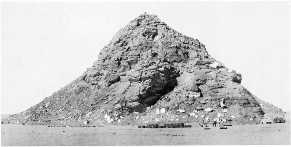
Pottery Hill from the south: at foot, petrol and water supplies of Prince Kemal el Din’s Expedition of 1923
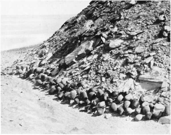
Jars at northern foot of Pottery Hill found by Prince Kemal el Din in 1923
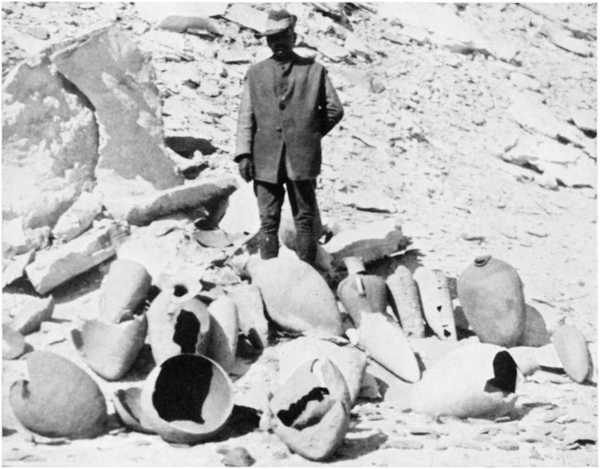
Jars, worn away by sand-laden winds, found by Dr. Ball in 1917 at southern foot of Pottery Hill
There is another method now available to us by which we may narrow down the search for Zerzura or other “lost” oases; and that is, by a consideration of the general contours of the country and those of the static water-surface. Every oasis in the Libyan Desert must owe its existence to one or other of two conditions: either it must depend on springs fed by local rainfall, in which case, like the oases of Owenat and Arkenu, it probably lies near to mountains of considerable height; or else it must depend on underground supplies, and must therefore lie in[125] a depression wherein the ground-level and static water-level are practically coincident, as in the cases of Kharga, Dakhla, Farafra, Baharia, and Siwa. It is highly doubtful whether any mountain masses at all approaching the altitude of Arkenu and Owenat can remain undiscovered in any of the various areas in which Zerzura has been traditionally placed. Zerzura is immensely more likely to be in a depression, and indeed Wilkinson’s name Wadi Zerzura almost conclusively points to that view. The depression is more likely to be shallow than very deep, for it presumably lies in the sandstone country of the south-west, and all the known depressions of great depth are confined to the limestone country of the north-east. It is quite easy to trace out on our new map the areas wherein the static water-surface would be reached by a depression of say 50 or 100 metres below the general ground-level as indicated by the contours. We must, however, remember that our ground-contours are liable to be considerably in error in areas where observations have been few—that is, in precisely those areas where the depression, if it exists, is most likely to be found. So we must allow a good margin for our depth, and I have chosen 100 metres on this account. On the map I have drawn the “locus” of points in the southern part of the Libyan Desert where the static water-surface is 100 metres lower than the general ground-surface[34]; and I have edged with red the only areas in the west and south in which the two surfaces are within 100 metres of each other—that is to say, the areas within which comparatively shallow depressions with underground springs must lie, if our contours of the two surfaces are drawn with even approximate correctness. It will be seen from the map that this restricts the search very considerably. In fact, if Zerzura is within the frontiers of Egypt, it lies in all probability either to the west of longitude 26° 20′ and north of latitude 26°, or to the east of longitude 27° and south of latitude 23° 30′. We may dismiss from our field of search all the broad tract of rising ground which extends from near the Dakhla escarpment south-westwards towards Owenat; for unless Zerzura is in a depression of great depth, it cannot possibly lie within this tract. This consideration shows that most of the previous rough estimations of the possible position of Zerzura must have been erroneous; and indeed it is remarkable how few of the various explorers’ tracks traverse the only two areas within which Zerzura, if it exists, almost certainly lies. The northern area has only been crossed by the Rohlfs expedition of 1874, and that near its eastern edge; while the western part of the southern area has only been crossed by Prince Kemal el Din’s expedition of 1925. Of all the Arab traditions, only those which would place Zerzura far to the west of Farafra, or far to the south-south-west of Dakhla, can now have any high degree of credibility. It can hardly, I think, be doubted that the[126] various traditions refer to more than one place; and in view of the almost totally unexplored state of the only two areas in which our new contour-maps indicate the possibility of unknown oases existing, it is quite conceivable that at least one oasis may lie within each of them. In the northern area, Siwa would probably make the best starting-point from which to conduct a search, as it is easily reached by motor-car from Alexandria or Cairo, and exploratory journeys southwards from Siwa would mostly lie along the direction of the dune axes. In the southern area, Terfawi or Sheb would form the best base for exploration; at each of these places there is a good water-supply. I am inclined to think that the southern area is more likely to yield results than the northern one. Water was found to exist at a point some 15 kilometres west of Terfawi, and though no other source was observed on the way to Owenat, it was impossible to see very far on either side of the track, so that such a source might have been passed within a few miles without notice. Terfawi itself is very difficult to find, being inconspicuous even when one is fairly close to it; and as it is in a sandy area, tracks leading to it are soon obliterated. Another factor which favours this southern area is that, the country being all Nubian sandstone, the depth from the surface to the actual water-bearing beds (as distinguished from the depth to the static water-surface) is certain to be much less than in the northern area, where Cretaceous strata may overlie the sandstone; hence there is more likelihood of the existence of natural springs in the south than in the north.
9. Can Travel in the Great Tracts of the Libyan Desert which are now Waterless be facilitated by the Sinking of New Wells?
It has sometimes been asked whether tracts which it is now difficult or impossible to cross by camel, owing to the non-existence of wells or natural springs within them, might possibly be opened up to transport by the sinking of new wells along a proposed route, as has in fact been done by the Senussi in the case of the well at Sarra, between Wanianga and Kufra. Hitherto there have been no data from which to form an opinion on this question; but a study of the new map will enable at least a qualified answer to be given.
To be a practicable proposition, a new well must fulfil two conditions: the first, that the boring must not be required to descend to a very great depth; and the second, that the water when struck must rise in the bore to within a reasonable distance, say 20 to 30 metres, of the ground-level at the place. The first of these conditions will be satisfied if the geological horizon of the water-bearing bed is comparatively near the surface; the second, if the level of the static water-surface in the locality is within 20 or 30 metres of the ground-level.
As regards the first of these conditions, we know that the water-bearing beds underlying the Libyan Desert are situated within the geological[127] formation called the Nubian sandstone. We may therefore eliminate from our consideration all tracts in which this formation is overlain by any great thickness of younger rocks, for all these rocks will have to be passed through in order to tap the water-bearing strata.
Concerning the second condition, our map at once informs us that the areas in which the static water-surface is within 20 or 30 metres’ depth below the ground-level are decidedly limited. Even if we suppose that there may be unknown depressions extending to a depth of 70 metres below the general level of the country indicated by the contour-lines, we see that the localities in which the second condition would be fulfilled are confined to the tracts edged with red on the map. Outside these tracts, not only have we no chance of discovering oasis-depressions, but we also have no prospect of being able to bore wells in which water would rise to within a reasonable distance of the ground-level. Thus the broad tract of rising ground which extends south-westwards from Dakhla to Owenat must always remain a waterless waste.
In the Egyptian portion of the Libyan Desert there are, as will be seen from the map, only two areas in the west and south in which new wells might successfully be bored: one extending for some 300 kilometres or so to the south of Siwa Oasis in the neighbourhood of the western frontier, the other extending for some 400 kilometres westward from the Nile in the neighbourhood of the southern boundary. Fortunately, however, these areas are so situated that wells sunk within them might be of considerable use in opening up the outermost parts of Egypt to exploration. A well near the western frontier about on the parallel of 26°, for instance, might make it just possible for cars or camels to reach Owenat directly from Siwa, since it would divide the present waterless stretch of 830 kilometres into two stretches of about half that length; while one or two wells near the southern frontier between the meridians of 27° and 28° would render Owenat fairly accessible to camels coming from the Nile viâ Terfawi or Sheb, and might be of great use to explorers or geologists desirous of making a detailed investigation of the Owenat and Arkenu region. From the little I saw of Gebel Owenat during my visit to it in 1925, its geology must be of extreme interest. The south-western part of the mountain appears to be entirely composed of granite and other crystalline rocks, while the eastern part presents huge cliffs of sandstone, with crystalline rocks showing only at the foot; there is evidently a great fault traversing the mountain mass, with a downthrow to the east; and the thickness of Nubian sandstone exposed on the eastern precipices is greater than that at any other place I have seen.[35] Gebel Kissu probably resembles the south-western part of Owenat in being[128] entirely composed of crystalline rocks.[36] East of Gebel Owenat there are many igneous hills, some of which exhibit bands of a dark brown colour. These bands, though probably mostly igneous dykes, may possibly in some cases be the gozzany outcrops of veins containing metallic minerals; I had no opportunity of examining them at close quarters, but I saw enough to make me long for facilities to undertake such an examination.
It may be remarked that a well in the northern area would probably have to be very deep, owing to the comparatively high geological horizon of the surface rocks there; but in the southern area, where the Nubian sandstone forms the surface rock, no great depth of boring would be likely to be required in order to tap the water-bearing beds.
Apart from the question of new wells in the more remote parts of the Libyan Desert, a study of the map gives us some hints which may be of value should it ever be desired to sink wells in places nearer to the oases and to the well-known tracks. There appears, for instance, to be no reason why wells should not be successfully bored at intervals along the Darb el Arbain between the south end of Kharga and Lagia, or on the south side of the Qattara and other depressions of the northern part of the desert. In the southern area, the best sites to select for wells will be depressions wherein the ground-level approximates most closely to the static water-level; and readings of an aneroid barometer, compared with corresponding readings at a place of known altitude, such as Sheb or Terfawi, would enable the most favourable sites to be determined. Observations of the geological structure will also be of importance; for anticlinal folds, by bringing the water-bearing strata nearer to the surface, would diminish the depth to which borings would have to be carried to tap the beds; while faulting might likewise introduce favourable conditions by producing cracks and fissures along which the water could rise. It may be remarked that tamarisk-bushes are generally a sign that water exists at no great depth. In regard to wells in or near the northern depressions, it is obvious that sites on the south side of the lakes and salt-marshes should be selected; for not only is the artesian static level higher in the south, but the water is less likely to be contaminated by salts derived from the lake and marshes.
[No. 3
209]10. The “Tortoise Marshes” of
Ptolemy.
The passage in Ptolemy’s ‘Geographia’ (lib. IV. cap. 6, sect. 4) in which the position of the “Tortoise Marshes” is given may be translated as follows[37]:
There are two great rivers running into the Mediterranean; one of them is the Gir, joining Mount Usargala with the Garamantic narrows, from which, changing its course, the river is located in long. 42°, lat. 16°, and makes the Tortoise Marshes (Chelonitides Paludes), whose position is long. 49°, lat. 20°.
The information on which Ptolemy based this statement, at least as regards the river Gir, must have been very fragmentary, if not, indeed, grossly erroneous; for there is no river flowing to the Mediterranean anywhere near the positions he gives. But there can be little doubt that his names Gir and Chelonitides Paludes refer to real places, and there has been much speculation among geographers as to their identification.
Thus, for instance, Knoetel[38] suggested that the Gir may have been the Wadi Djedi, to the south of Biskra, and the Tortoise Marshes the modern Lake Melghir (lat. 34°, long. 6°)[39] Dr. William Smith[40] thought that the Gir was really a branch of the Niger, and the marshes the modern Lake Fittri (lat. 13°, long. 18°). On the map of Africa on the 2-million scale published by the Geographical Service of the French Army in 1899 the Tortoise Marshes are depicted as lying in about latitude 19° 20′,[210] longitude 27°, with a note stating that this delineation is taken from an earlier map of the Nile Basin by Miani, who regarded the marshes as being connected with the “dry river” which was then supposed to run northwards through Dakhla Oasis. Colonel Tilho has lately suggested[41] the lowlands to the north-east of Lake Chad (lat. 18°, long. 17°) as a possible site for the marshes; while still more recently Mr. Harding King[42] has thought that they might perhaps be identified with the salt lake of Merga (lat. 19° 3′, long. 26° 19′).
Of the various localities which have been suggested as possible sites for the Tortoise Marshes, the only one which I have visited is Merga. I found the salt lake at that place to be very small, covering only some 10 acres; it lies at an altitude of 509 metres above sea-level, and though it is situated in a rather wide shallow depression, I saw no traces of any extensive salt-marshes around the lake, while the configuration of the surrounding country appeared to me to be such that the depression cannot possibly have formed part of a continuous drainage-channel.
I do not know whether it has hitherto been suggested that Kufra Oasis may be the site of the Tortoise Marshes; but on correcting Ptolemy’s figures for the errors in his adopted position for Alexandria and in the length which he assumed for a degree of latitude, I find Kufra is in very much closer agreement with them than any of the places named above. In Ptolemy’s day, even the latitudes of but few places had been astronomically observed (Alexandria, where he himself resided, was supposed by Ptolemy to be in latitude 31°, instead of its true 32° 12′), and as the only method at that time known for astronomically determining differences of longitude was by the observation of eclipses, the number of observed longitudes was smaller still. The process by which Ptolemy deduced his position for the Tortoise Marshes and other places in the interior of Libya was most probably that of first estimating their distances south and west of Alexandria from travellers’ itineraries, then converting these distances into degrees of latitude and longitude, and finally subtracting the differences thus found from the latitude and longitude of Alexandria. But Ptolemy made the great mistake of assuming the length of a degree of latitude (or of equatorial longitude) to be 500 stades, instead of the 700 stades which it really is. Thus all his dead-reckonings resulted in differences of latitude and longitude which were too great in the proportion of seven to five. If we correct Ptolemy’s position for Alexandria, and his dead-reckoning for the erroneous assumption which he made regarding the size of the Earth, as follows:
| Latitude. | Longitude. | ||
|---|---|---|---|
| Ptolemy’s position for Alexandria | 31° | 60° 30′ | |
| Ptolemy’s position for the Tortoise Marshes | 20° | 49° | |
| Ptolemy’s difference of lat. and long. | 11° | 11° 30′ | |
| [211]These differences reduced in the proportion of 5 to 7 become, in true degrees and minutes | 7° 52′ | 8° 12′ | |
| The true position of Alexandria is | 32° 12′ | 29° 53′ | |
| Whence the corrected position for the marshes in our modern system becomes | 24° 20′ | 21° 41′ |
we get lat. 24° 20′ and long. 21° 41′ for the Tortoise Marshes. Comparing this position with that of Kufra, we find that the latitude agrees very closely with the 24° 14′ which Hassanein observed at Taj, the principal village of that oasis; while the longitude, though more than a degree and a half west of that of the principal village, is almost exactly correct for Taiserbo, the north-western oasis of the Kufra group.
Besides this remarkably close agreement as regards position, Kufra presents several natural features which would tend to support the view that it may be the locality which Ptolemy meant by the “Tortoise Marshes.” Not only is Kufra an extensive tract of relatively low-lying ground with numerous lakes and salt-marshes of very considerable size, but it has distinctly the form of a valley. Hassanein Bey repeatedly refers to it as a valley in his description[43]; Mrs. Forbes also speaks of the “Wadi of Kufra,” and mentions that as a result of a ride westward from Taj the “wadi” was found to have no definite ending to the west.[44] What more natural, therefore, than that some ancient traveller should have imagined that Kufra was a series of marshes formed by a river coming from the south-west? And is it not possible that Ptolemy, in endeavouring to piece together the scraps of information he could get, may have mistakenly inferred that this river ultimately reached the Mediterranean, and also have confused the account of it with those of other streams further south, which may have been branches of the Niger?
11. The Sand-Dunes.
The sand-dunes of the Libyan Desert have been the subject of careful studies by Mr. Beadnell and Mr. Harding King, and practically all that was known concerning them up to the outbreak of the Great War is contained in the excellent papers by them which were read and discussed at meetings of the Royal Geographical Society in 1910, 1916, and 1918.[45]
With the commencement of the Senussi campaign in Egypt in 1915, the sand-dunes sprang into new and unexpected importance, from the fact that they formed one of the principal hindrances to the free movement of troops, and more especially of military motor transport, across the desert. Every line of dunes of any considerable extent had now to[212] be carefully mapped and examined for possible car-passages through it; the result was to add greatly to our knowledge of the distribution and extent of these remarkable features of the Libyan Desert, especially in the northern parts, where many long lines of dunes were found of which the existence was previously unsuspected by geographers, though they are familiar landmarks to the Bedouin of the region, and all except the smallest bear Arabic names. After the cessation of hostilities, interest in the distribution of dunes was maintained, because of the increasing use of motor-cars in place of camels for transport across the desert; and this circumstance has recently led to light being thrown on the distribution of the dunes in those southern regions which lay outside the field of operations during the war.
It is rather curious to note that although the sand-dunes form the greatest obstacle to motor-cars in the desert, yet it is chiefly by means of motor-cars that the true extent and distribution of the sand-dunes has been ascertained. Dunes are the most difficult of all desert features to map properly by ordinary reconnaissance methods with camel transport. Their smooth outlines provide no points on which intersections can be made, and no survey marks put on them will remain in place for more than a few hours, or at most a few days; they occur mostly in nearly level country, where it is impossible to find a station whence they can be overlooked; the absence of shadows on them renders it impossible to say whether one is looking at a single line of dunes, or at several lines, miles apart, one behind the other in echelon. The only sure way of mapping dunes is to traverse their sides along their entire length, and this is impracticable with camels owing to the enormous distances which would have to be covered without water. But with motor-cars one can run alongside them at 40 kilometres an hour instead of the camel’s 4, and their distribution can thus be rapidly and easily ascertained.
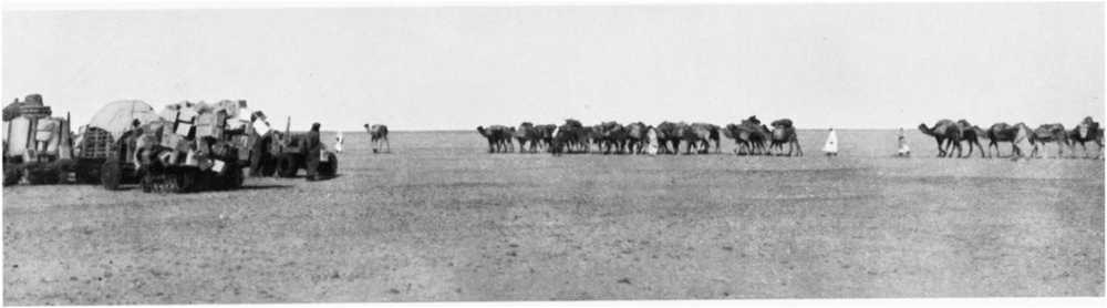
Prince Kemal el Din’s expedition of 1925 leaving Bir Terfawi for the waterless journey of 250 miles to Owenat
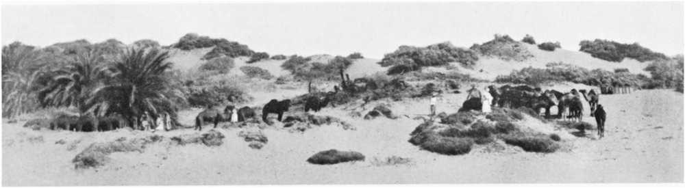
The well at Bir Terfawi in the palm clump
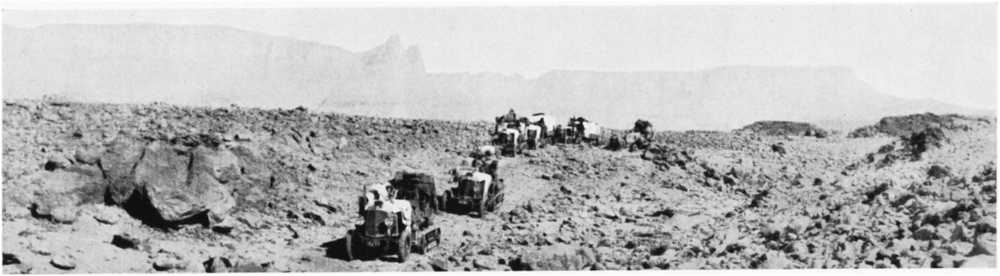
Jebel Owenat from the south: the triple peak (5635 feet) in centre
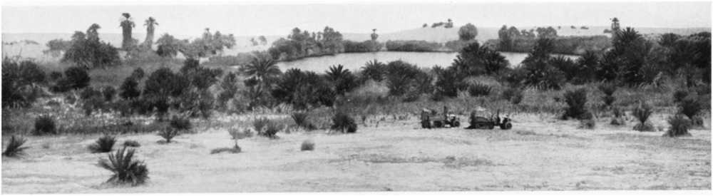
The lake at Merga located by Prince Kemal el Din’s expedition of 1925
On the map I have shown the distribution of sand-dunes as far as it is known at the present day. A comparison of this latest map with that given by Mr. Beadnell in his paper of 1910 will show how large is the number of dunes discovered and mapped in more recent years; and it will be noticed how pronounced is the constancy of the general direction of all the lines in the Egyptian portion of the Libyan Desert. Though no new lines of dunes comparable in extent with the great Abu Moharik belt have been added to the map, some of the newly discovered lines are of very considerable length, and they show an even more remarkable ratio of length to breadth than the Abu Moharik belt; the Ramak dunes, for instance, extend from near Moghara south-south-eastwards in a straight line for more than 100 kilometres, with only a single small break, and their width nowhere exceeds 1 kilometre. Moreover, the linear arrangement in a direction from about 20° west of north to about 20° east of south is even more pronounced in the newly discovered northern dunes than it is in those previously known farther south. In the “great[213] sand sea” of Rohlfs, to the west of Dakhla and Farafra, the same directional arrangement of the individual lines of dunes is very noticeable, at least in the part near “Regenfeld” where I have penetrated it; and I found the same general direction to hold for most of the lines of dunes which I crossed on the way from Terfawi to Owenat. During the war I received a number of reports of dunes extending nearly east and west, often in curved lines; but investigations on the spot showed practically all these reports to be erroneous, the commonest mistake having been that of sighting different lines of dunes from different places under the impression that they were a single one.
The general south-south-easterly direction which is so marked a feature of the lines of dunes in the Egyptian portion of the Libyan Desert is not, however, preserved in the extreme south-west of the country. The line of dunes which crosses the Egypt-Sudan frontier in longitude 25° 40′ has a direction of about 30° west of south, and the dunes which extend from near Gebel Arkenu to the west of Gebel Owenat run about 38° west of south. From a point about 80 kilometres to the south-west of Gebel Owenat, the dune-lines make a still further distinct bend to the west, changing their direction by some 20° to about 58° west of south, and this latter direction is maintained by the dunes in the neighbourhood of Sarra Well.[46] According to the maps of Rohlfs and Mrs. Forbes, the dunes in the sandy tract to the north-west of Kufra follow approximately the same bearing as those near Sarra. The suggestion has been made that this swinging round of the direction of the dunes in the south-western part of the Libyan Desert may be due to a deflection of the prevailing wind by the mountain-masses. It is almost certainly caused by differences in the prevailing winds—in fact, the dune-lines probably afford a very exact index to the general wind-direction in the areas where they occur—but I am inclined to think that the regional distribution of atmospheric pressure, rather than local deflection by mountain masses, is the cause of the differences of wind-direction. The dunes, especially those near Sarra and Kufra, extend into localities which seem to me to be too distant from the mountains for the influence of the latter on the prevailing winds to afford a satisfactory explanation.[47]
In certain areas, especially in the south, as for instance on the Arbain road from Kharga to Sheb, around Pottery Hill, and in the region between Owenat and Erdi, there are sand-covered tracts which can[214] hardly be mapped as dunes, because there are no very marked crests. These tracts are easily crossed by camels, but give much trouble with cars, and would probably be classed as dunes by car-drivers; but they are really only vast undulating fields of drifted sand. On the old Darb el Arbain slave road between Kharga and Sheb, one travels for more than 100 miles over drifts of this kind. No footprint of camel marks the track, footprints being obliterated in an hour or two. But one is never in doubt about the way, for it is indicated by the skeletons of countless camels which have perished on the weary march.
As regards the relation between dunes and the relief of the ground, there is a gradual rise in the general level of the country from north to south of about 1 in 1000, so that the southern ends of most of the Egyptian lines of dunes lie at higher altitudes than the northern ends; but I am fairly certain that this slight general inclination has nothing to do with dune-formation. The straightest and cleanest-cut lines of dunes are found in the flattest and most open parts of the desert, over which the wind can sweep without obstruction. When a line of dunes encounters in its southward progression a sudden fall in the ground-level, as for instance at the north end of Kharga Oasis and to the east of Pottery Hill, it usually breaks up; sometimes, as in Kharga, to resume its course as dunes in more open formation, and at other times, as near Pottery Hill, to spread out into a rolling plain of drifted sand. It is not uncommon for the south end of a line of dunes to split up, even on level ground, and the same can be seen, though less often, at the northern ends; but this is probably merely because the dunes are lower near the ends of the lines, and the width of the individual dunes is consequently less.
The great lines of dunes are probably extending southwards at a very slow rate, under the action of the prevailing wind. In this connection it is interesting to note that Arabs always speak of the south end of a line of dunes as its head, and of the north end as its tail; just the opposite of what one would instinctively call them from merely looking at the map, but correct if the dunes are known to have a southward progression. Mr. Beadnell found the average rate of progression of isolated small dunes in Kharga to be 15 metres per annum; but he remarks that large dunes move more slowly than small ones, owing to the greater mass of material to be transported. It is interesting to make a rough guess at the antiquity of the dunes from the length of certain of the longer lines and an estimated rate of progression. The Abu Moharik belt, for instance, has a total length of about 350 kilometres; hence, if its tail has remained stationary and its head has advanced southwards at an average rate of 10 metres a year, some 35,000 years must have been occupied in its formation.
As regards the height of the dunes, the only one I have carefully measured is that close west of Rohlfs’ camp at Regenfeld, which I found to be exactly 30 metres. Some of the dunes in the Abu Moharik and[215] Ramak belts are considerably higher; but I doubt if any of the Libyan dunes rise much over 50 metres above ground-level, except in the “great sand sea” which commences some 14 kilometres to the north-west of Regenfeld, where Jordan estimated them to attain 100 metres or more.[48] The top of a high dune to the south of Melfa Oasis was found by triangulation to be 172 metres above sea; the level of the ground at its foot is unknown, but is probably not very much above the sea-level, so that Jordan’s estimate of the height of some of the dunes in the “sand sea” is probably by no means an exaggerated one.
Much has been written about eddies in connection with dune-formation. The only observations I have made in this connection have been when endeavouring to place temporary marks on dunes to form survey-points; and the observations seem to show that if eddies are artificially created at the top of a dune, a rapid lowering of the dune-crest results. At first I used to thrust a walking-stick or ranging-rod some 2 or 3 feet into the dune-crest. The stick or rod, though quite firmly fixed at first, was always found after a few hours lying halfway down the dune-slope. The same thing happened with tripods firmly pressed down into the crest. When I was carrying out a little triangulation to determine the position of Rohlfs’ cairn at Regenfeld in 1924, I had occasion to place a mark on a high dune, and I used an empty 4-gallon petrol tin filled with sand, bedding it well into the dune; but the next day it had disappeared from the crest, and was found, as the other things had been, halfway down the slope. These observations remind me of Mr. Barclay’s description of the method of dealing with sand-accumulations in the Peruvian Desert,[49] where, as soon as dunes appear and threaten to obstruct a railway, the local inhabitants turn out and scatter pebbles and stones on the dunes, and very soon the dunes are gone, having been carried away owing to eddies produced by the wind around the stones. This device for removing incipient dunes might, I think, be tried along the Kharga Railway, where the screens put up at Mr. Harding King’s suggestion have not been entirely successful in preventing the encroachment of sand on the line. I am the more disposed to think an experiment of this kind might succeed, because I have noticed that at the gap in the Ramak dunes (discovered by Col. Partridge and known during the war as “Partridge Gap”) there are great lumps of silicified wood, which may have led to the gap being formed.
There are two other physical characteristics of dunes which I do not remember having seen mentioned. One of these is their low thermal conductivity. On a hot day, one has only to thrust one’s hand a few inches into a dune to encounter cool sand, while on a bitterly cold day one can warm one’s hands by the same action; thus while the diurnal[216] variation of temperature of the surface of a dune is frequently very great, it is almost insensible at quite a shallow depth in the interior. It follows that diurnal expansion and contraction of the grains composing the dune must be confined to the superficial layers, and the movements thereby caused may materially assist in consolidating the dune, by causing a “packing” of the grains. The other characteristic I have noticed is that the surfaces of the dunes always appear to be harder underfoot in the cool of the early morning than in the heat of the day. This may, of course, be an illusion owing to one’s being less sensitive to fatigue in the early morning, when one’s body has been refreshed by sleep, and when the air-temperature is comfortable; but I have often fancied there is more in it than that, and it may easily be that the “packing” which has taken place owing to the considerable fall of temperature in the night, to say nothing of the action of dew, may have caused a real compacting of the surface layers.
In his paper of 1910, Mr. Beadnell considered that the sand composing the dunes must be derived from arenaceous formations to the north, and he made special mention of the need for a careful survey of the region in which the dunes originate. A reference to the map will show how correct was Mr. Beadnell’s surmise, at least in the case of the Egyptian dunes which he had studied. The dunes originate in the great depressions which stretch from Siwa to the Wadi Natrun, where, as Mr. Beadnell inferred, the supply of arenaceous material from the loosely compacted Miocene and Oligocene beds is almost inexhaustible. We have here one of the clearest possible examples of the powerful action of the wind as an excavating and transporting agent. The Qattara depression has been excavated, largely by the wind, to a depth of over 130 metres below sea-level, and the excavated material has been carried southwards, some of it for nearly 1000 kilometres in distance and more than 500 metres in height, to form the dunes. We see not only the excavated hollow, but also the transported and piled-up arenaceous material removed from it; and the total quantity of rock thus removed and re-deposited must amount to hundreds of cubic kilometres.[50]
It is noticeable, however, that to the north of the “great sand sea” of Rohlfs, which extends for an unknown distance westward, the known depressions are much shallower; and yet the total quantity of sand in this region is probably greater than that of all the more easterly dunes put together. The country between Jarabub and Jalo is however[217] almost unexplored, though it is known to be very sandy and to be the theatre of violent sandstorms. Whether similar deep depressions to that of Qattara have been excavated along, or to the north of, the Jarabub-Jalo road, or whether the area of loosely compacted arenaceous rocks exposed there is so enormous as to have yielded such a quantity of sand without any very deep depressions being formed, is a point that can only be cleared up by further exploration in Cyrenaica.
We now come to the most puzzling of all the questions connected with the sand-dunes, namely, why do they persist as sharply defined long narrow lines in certain places, while the ground elsewhere is almost absolutely free from sand? As Mr. Harding King puts it, the dunes appear to have a curious power of collecting all the sand in the neighbourhood.[51] The sheltering effect of ripples in the dunes, and a “shepherding” effect of winds a point or two off the normal, have been suggested as possibly affording some explanation of this apparent collecting-power,[52] but neither of these suggestions appears to be adequate. I think a more direct explanation is possible; namely, that the dunes really have the power of attracting sand from the air, and that this power is due to the well-known law of attraction between a conducting surface at zero potential and an electrically charged body. That air-borne sand-grains in the neighbourhood of a dune may carry electric charges was shown by Mr. Harding King’s experiments, recorded in his paper of 1916, and I have since found sand-grains to carry electric charges of high voltage during sandstorms in Cairo. As to how the grains become charged with electricity, it can hardly be due to friction against each other, for the sand is remarkably uniform in composition, consisting generally of rounded grains of almost pure silica coated with a thin translucent film of ferric oxide,[53] and for the production of frictional electricity it is generally regarded as necessary that the two bodies which are rubbed together should be of dissimilar materials;[54] nor is it likely that they are[218] electrified by friction with the air, for they travel with it. But if the particles are carried into an upper air-stratum, they will gradually acquire its potential by conduction; and the ordinary potential gradient in the air in Egypt is over 100 volts per metre of height.[55] Hence a sand-particle carried along for some time in the air at a height of only 20 metres above the ground may become charged to 7 electro-static units of potential, or 2100 volts; and on approaching a dune rising to about that height it will be attracted to the dune, which being in connection with the earth is at zero potential. The attraction will be very small unless the sand-grain approaches very closely to the surface of the dune; from some calculations I have made, a spherical grain of silica half a millimetre in diameter charged to a potential of 2100 volts will not be attracted with a force equal to half its own weight until it approaches within a centimetre of the conducting surface, and the grain will have to approach within 7 millimetres of the surface before the attraction is equal to the weight of the grain. But the important thing to note is that the attraction is independent both of the sign of the charge and of the direction of the wind which carries the particle. Another way of looking at the matter is to consider the probable distribution of the equipotential surfaces in the air about a dune, as in the diagram below, which represents a section taken perpendicular to the direction of the wind and to the axis of the line of dunes:
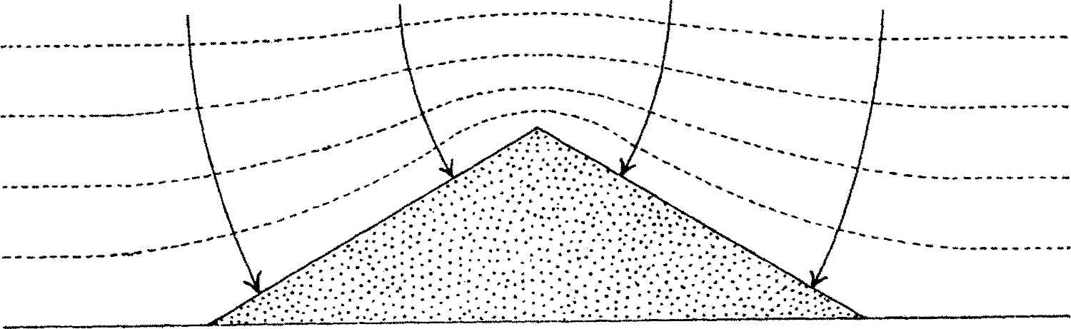
Diagram showing suggested distribution of equipotential surfaces and directions of lines of force in the neighbourhood of a sand-dune
The equipotential surfaces, shown by dotted lines, will be squeezed together over the dune, and the electric forces, shown by full lines and arrows, being everywhere normal to those surfaces, will converge to the dune. Thus the dune will attract any particles carried by the wind and charged by conduction to the potential of the air conveying them. If the wind changes its direction, the attraction will still persist unaltered. Another point worth mention is that a sand-dune may be far more effective in its attraction of sand than a rocky ridge of the same size and shape[219] would be; for when the electrified grains approach the surface of the dune, uncharged grains can rise from the dune to meet them; possibly some of the dancing of sand-grains which is frequently observable along the crest of a dune during a wind may be due to this cause.[56] During violent sandstorms, particles of sand may be whirled aloft and kept suspended at high altitudes for a period long enough for them to acquire very high potentials, and a sudden cessation of the storm may cause them to fall so rapidly that much of the charge may be retained; in which case, of course, electrical attraction may cause a very considerable deviation from the purely gravitational paths of the falling particles, the deviation being always towards the dune. Since the closeness of the equipotential surfaces and the mobility of the sand-grains composing the dune are greatest along the dune-crest, the maximum rate of deposition will be at the top of the dune, which is also the place where the wind exerts its greatest action in conveying the sand of the dunes southward. That the long axes of the lines of dunes do really correspond with the direction of the prevailing wind is certain, both from Mr. Beadnell’s observations of wind-direction[57] and from the fact that the scoring of the limestones in the Libyan Desert by wind-borne sand coincides in direction with the lines of dunes.[58] Thus I suggest that while the extension of the lines of dunes southwards is purely the result of the prevailing north-north-west wind, their clean-cut character and narrow width is the consequence of lateral attraction by the dunes themselves on the flying electrified particles of sand.
If the hypothesis I have ventured to put forward is regarded as likely to furnish the true explanation for the formation of the lines of dunes, I hope that someone possessing the necessary skill in electrostatic measurement will put it to a crucial test, by carrying out observations on and near the dunes themselves. If a number of flying sand-grains could be caught from different levels in an insulated metallic receiver connected to an electrometer, the readings of the electrometer would enable the potentials to which the grains were charged at different levels to be calculated, provided the electrostatic capacity of the receiving system and the number and diameter of the grains giving up their charge[220] were measured. Allowance would, of course, have to be made for any electrification of the receiver by the air, or by uncaught sand-grains, as well as for losses by imperfect insulation of the collecting system. In a preliminary experiment of this kind which I made in Cairo during a sandstorm, leakage from the electrometer was found to be so great as to vitiate any attempts at accurate measurement; but I think this particular difficulty could be overcome with a specially designed apparatus, or that at least the leakage could be measured and allowed for. The taking of observations of any kind in dune areas during windy weather is a most difficult and trying operation, and commonly means, in addition, a sojourn of some weeks in isolated and otherwise uninteresting areas. But the advent of the motor-car has so greatly facilitated communication in the deserts that difficulties of access are now not so great as they used to be; the south end of the 35-kilometre line of the Kattania Dunes, for instance, about 90 kilometres west-south-west of Cairo, which would form an excellent site for detailed observations, can now be reached by a four or five hours’ car journey from Cairo instead of the several days’ journey by camel which was formerly necessary.
12. The Distribution of Stone Implements.
I have not made any special study of stone implements, nor have I been able to pay any considerable attention to their collection during my journeys, having usually found my time very fully taken up with other matters. I have, however, been much struck by the wide distribution of stone implements in the desert. I have found them, for instance, not only in Siwa Oasis and near the wells of Abu Mungar and Sheb, but also on the plateau between Baharia and Farafra, on the open desert between Terfawi and Owenat, and to the south-west of Owenat near the Anglo-French boundary. This wide range of occurrence, coupled with the finds of Schweinfurth and others on the plateaux nearer the Nile, inclines me to think that there is scarcely any part of the Libyan Desert in which stone implements might not be found by an expedition which would make the collection and study of them one of its main objects. The likeliest places in which to search (besides the neighbourhood of old wells and springs) would appear to be the shores of the various lakes and around the feet of hills affording shelter from wind and sun; for it is in such localities that I have most usually come across implements and pottery. Grinding-stones, often with a sort of stone rolling-pin, unpolished celts, knives, and arrow-heads are the principal forms of implement I have met with. Many of the grinding-stones must have been carried for a considerable distance, for they are made out of rocks which do not naturally occur in the localities in which they are found.
Whether this wide distribution of stone implements would justify the view of Blanckhenhorn[59] that primitive man lived on the desert plateaux[221] rather than in the Nile Valley must, I think, be settled by the further collection of specimens and by a careful comparison of the forms to be found in the two situations. In this connection I may remark that the grinding-stones I have seen in the desert seemed to me to be very similar to those used by the Nubians of the Nile Valley to-day for grinding corn.
APPENDIX
SOME RECENTLY DETERMINED POSITIONS IN THE LIBYAN DESERT
In view of their possible utility in connection with future exploratory surveys, I give below a list of some of the more important of the positions which I have recently determined by astronomical observation in the southern part of the Libyan Desert, with brief descriptive notes on the places to which they refer. The observations were made whilst accompanying H.R.H. Prince Kemal el Din Hussein on his exploratory motor-car expeditions of 1923, 1924, and 1925. The longitudes of Qasr Farafra, Abu Mungar, Pottery Hill, and Regenfeld depend on the transport of a box-chronometer; the others on wireless time-signals from Europe. The positions of peaks were found by triangulation from the actual observation-spots. The altitudes of camps are from careful barometric determinations; those of the peaks depend on trigonometric levelling from the camps.
| Place. | Lat. N. | Long. E. | Altitude above sea. Metres. | |||||
|---|---|---|---|---|---|---|---|---|
| ° | ′ | ″ | ° | ′ | ″ | |||
| Merga, Camp 600 metres S.W. of west corner of salt lake. (Lake surface is 17 metres below level of camp.) | 19 | 2 | 29 | 26 | 18 | 32 | 526 | |
| Bir Terfawi, Camp close to well and palms | 22 | 55 | 12 | 28 | 52 | 51 | 244 | |
| Gebel Kissu, Summit | 21 | 34 | 59 | 25 | 8 | 26 | 1726 | |
| Gebel Owenat, highest point | 21 | 54 | 34 | 25 | 0 | 47 | 1907 | |
| „ „ remarkable triple peak | 21 | 53 | 51 | 25 | 1 | 39 | 1718 | |
| „ „ S.W. peak | 21 | 49 | 35 | 24 | 53 | 52 | 1450 | |
| Chunk Hill, Summit | 21 | 52 | 46 | 25 | 13 | 56 | 985 | |
| Owenat, Camp 600 metres S.E. of western spring, on plain at foot of mountain | 21 | 48 | 35 | 24 | 51 | 45 | 568 | |
| Owenat, Camp at mouth of gully, about 800 metres S.S.E. of eastern springs | 21 | 53 | 8 | 25 | 7 | 58 | 626 | |
| Gebel Kamil, Summit (160 metres above plain) | 22 | 16 | 31 | 26 | 38 | 11 | 800 | |
| Regenfeld, Rohlfs’ cairn of 1874, rediscovered 1924 | 25 | 10 | 49 | 27 | 24 | 22 | 470 | |
| Pottery Hill, Summit (39 metres above plain) | 24 | 26 | 27 | 27 | 38 | 54 | 506 | |
| Sheb, Camp close to well, 240 metres N.N.E. of fort | 22 | 19 | 48 | 29 | 45 | 46 | 228 | |
| Mut, Government Rest-house | 25 | 28 | 37 | 28 | 58 | 24 | 119 | |
| Abu Mungar, Camp at small ruin, 400 metres E.S.E. of well | 26 | 30 | 22 | 27 | 35 | 29 | 117 | |
| Qasr Farafra, Camp E. of village, 200 metres S.W. of Tomb of Sheikh Dakhil | 27 | 3 | 26 | 27 | 57 | 52 | 90 | |
Merga.—To geographers the most important of the new determinations will undoubtedly be that of the uninhabited oasis of Merga, which had not previously been visited by a European, and of which the situation could hitherto only be guessed at from Arab statements. Merga lies in a shallow depression about 50 metres deep, broken by sandstone hills and sand-dunes, and extending[222] for some 20 kilometres north-east and south-west. The salt-lake, near the centre of the depression, measures about 300 metres by 150. It is surrounded by tall rushes and sandhills except at its south-western end. There are numerous date-palms, both near the lake and at considerable distances from it, as well as acacia trees and tamarisk bushes. The neighbourhood of the lake swarms with mosquitoes. Good and plentiful water was got by shallow digging about 1 kilometre south-south-east of the observation-spot, and could probably be obtained by digging almost anywhere in the depression. It is possible that the names Bidi and Tura el Bedai, shown with a question mark on some Sudan maps, may refer to different spots within the same depression. Owing to the plentifully scattered vegetation, the place cannot easily be missed, either by travellers passing within several miles of the lake, or by aircraft; but the landing of aeroplanes in the neighbourhood of the lake might be difficult owing to the extensive sand-drifts.
Bir Terfawi.—Scarcely less important than the accurate fixation of Merga is that of Bir Terfawi, the farthest south-west of all the Egyptian artesian water-sources hitherto known. It will be remarked that this latest determination places the well some 22′ south and 15′ east of the position which I had provisionally assigned to it from the rough data furnished by Lieut. Moore’s traverse of 1916.[60] A knowledge of the true position of Terfawi is specially desirable for a traveller who wishes to reach it, owing to the absence of any conspicuous landmark near it and to the sandy nature of the surrounding country, which causes tracks to be soon obliterated. There are numerous sandhills covered with tamarisk bushes around Terfawi, and a little grazing for camels. Besides the well at which observations were taken, water was found by digging in the sand at the foot of some tamarisk mounds about 13 kilometres farther west, and it is probable that good and plentiful supplies could be obtained at shallow depths near any of the other mounds. The palmtrees at Terfawi are few and small, and are less conspicuous than the tamarisk-bushes. These latter should enable the place to be easily found by aircraft; but landing would require some caution owing to the prevalence of drifted sand.
Gebels Kissu and Owenat.—The peaks of these mountains (especially that of Kissu, because of its isolated character and sharply marked summit) will form useful points for the connection of future surveys, being visible from very long distances.
Chunk Hill is a prominent isolated hill, nearly conical and of dark colour, which forms a good landmark in the broken country to the east of Gebel Owenat. It rises some 335 metres above the ground at its foot.
The Springs of Owenat.—Of the two water-sources of Owenat whose positions are given, the western one is the better, and is moreover very easy of access, being practically on the level of the plain which extends southwards from the mountain mass, and easily discoverable by the numerous animal-tracks converging to it; it is a pool among great boulders, obviously fed by percolation through cracks and fissures in the granite mountain which towers above it. The eastern water-source is less easy of access; it lies about 1 kilometre up a stony gully, and consists of a series of pools in the rocky floor of the gully, fed by trickling springs at the level where the granite is overlain by sandstone. The plain to the south of the western spring would form an excellent landing-ground for aircraft.
Whilst in the neighbourhood of Owenat, I had hoped to re-determine the[223] longitude of Hassanein Bey’s camp of 1923 with the aid of wireless time-signals, or at least by triangulation-connection to one of my observation-points, because a really accurate fixation of the longitude of a point about midway along his route from Jarabub to Furawia would possibly furnish the means of slightly correcting the longitudes assigned to Hassanein’s camps at Kufra and Erdi. I was unfortunately prevented from carrying out the desired connection; but from a hurried car-traverse which I made, skirting the western side of the mountain mass, in the course of which I must have passed pretty close to the site of Hassanein’s Owenat camp, I think that camp really lies about in longitude 24° 49′, or some 5 miles to the west of where I had previously calculated it to be from Hassanein’s traverse data;[61] and that in consequence the longitudes assigned to Kufra and Erdi from the same data may be some 2 or 3 miles too great.
Gebel Kamil is a sharply pointed hill of dark sandstone, forming a useful landmark between Terfawi and Owenat. It was visible from the east for more than 40, or from the west for about 20, kilometres. The name was given to it by Prince Kemal el Din in honour of his father, Hussein Kamil, the late Sultan of Egypt.
Regenfeld, it will be remarked, was found to be very nearly in the position assigned to it by Jordan in 1876,[62] and my estimation of the level of the place is only 20 metres higher than Jordan’s. The neighbouring dune I found to be 30 metres high, agreeing exactly with Jordan’s measurement of fifty years previously; and as far as I could judge, the situation of the dune relative to the cairn seems to have remained unchanged through this long interval, showing that there has been at any rate no great lateral displacement of the dunes. The iron tanks left by Rohlfs were quite intact, in spite of their half-century of exposure; they had become covered with a hard dark brown film, apparently of magnetic oxide of iron, not rusted in the ordinary way, a fact which speaks strongly for the dryness of the region. Empty wine-bottles left by the Rohlfs expedition were frosted by the sand-blast wherever they were exposed; but surprisingly little of the glass had been removed in this way.
Pottery Hill is the northern one of a pair of nearly conical dark sandstone hills about 40 metres high, which are conspicuous from some distance owing to their situation on a nearly level sand-plain. I gave it its name from the numerous jars which I discovered at its foot in 1917.
Sheb Well is a pool of fairly good water in a shallow excavation at the foot of a clump of dom palms, half surrounded by sand-dunes and tamarisk mounds, 240 metres north-north-west of a fort; the latter occupies a fairly conspicuous position on a sandstone hill about 25 metres high. Another well, situated at the foot of a clump of dom palms about 11 kilometres farther north, is called Bir Terfau; this should not, of course, be confused with the Bir Terfawi already mentioned.
To the north of Sheb, on the Arbain road, are three other water-sources which I visited in 1925 and of which I determined the approximate positions by a carefully controlled car-traverse: Bir Kassaba, in lat. 22° 41′, long. 29° 55′; Bir Abu Hussein, in lat. 22° 53′, long. 29° 55′; and Bir Murr, in lat. 23° 22′, long. 30° 5′. Bir Kassaba is a pool of good water at the foot of a clump of[224] palms; Bir Abu Hussein, which likewise yields good water, is a small excavation in sand near a hill of pink coarse-grained granite, and usually requires to be dug out afresh by each traveller; Bir Murr, on a little plain surrounded by hills, consists of several holes, with fairly good water, excavated in the sand at the south side of the outcrop of a steeply inclined bed of speckled calcareous sandstone.
I have not myself traversed the desert to the east of Sheb, but according to an intelligent Arab who has recently made the journey from Sheb to Dungul, there are only two spots between these places at which water is obtainable; they are Bir Abu Seifa, a small well of good water about 50 kilometres from Sheb, and Bir Haleifa, about 15 kilometres farther on, where there is a fort and numerous wells. This latter place must, I think, be the same as the Bir Nakhlai, of which the position found astronomically by Colonel Talbot in 1893 was lat. 22° 29′ 1″, long. 30° 19′ 36″.
The Rest-house at Mut, in Dakhla Oasis, is a low whitewashed building of three rooms, situated on open ground a little to the south of the village. It is conspicuous by reason of its isolation from other buildings, and forms a convenient starting-point for car journeys to the south-west of Dakhla, as well as for journeys to Kharga by the southern track which was mostly followed by cars during the war.
Abu Mungar proved to be very close to the position given by Mr. Harding King’s observations of 1912.[63] To the south-east of Abu Mungar, about halfway to Dakhla, are two remarkable hills forming outliers of the plateau. These hills, which are good landmarks, were first discovered by Mr. Harding King, and as they appear to possess no native name, I have called them “King’s Hills” on the map. The farther one of the two from the plateau lies in lat. 25° 58′, long. 28° 11′, from compass-bearings which I took to it on a careful car-traverse in 1924. The other is about 2 kilometres farther north.
Qasr Farafra.—The position of the village of Qasr Farafra which I gave in my paper of 1919[64] is proved to be very nearly correct by the latest observations. The main advantage of the new determination is that it is referred to an easily identifiable landmark, the tomb of Sheikh Dakhil, instead of to the ill-defined centre of the village.
Levels in or near Baharia Oasis.—I think it may be well to record here that owing to an unfortunate mistake about the datum to which the level of the old military railway-terminus at B6 was referred, all the altitudes given on pp. 10 and 11 of my above-mentioned Survey Department Paper of 1919 require a correction of 19 metres to be added. At the time when I triangulated Baharia in 1917, I was informed that the level found by the military authorities for the terminus was measured from the sea-level datum, and I employed the value given for it as my fundamental level. But I have since ascertained that an arbitrary datum was employed by the military engineers; and trigonometric levelling from the Nile Valley has shown that this arbitrary datum was about 19 metres above sea-level.
FOOTNOTES:
[1]The use of motor cars for reconnaissances in the Libyan Desert, initiated by the British Army during the Great War, has been considerably developed in the last few years by Prince Kemal el Din Hussein (son of the late Sultan of Egypt), who has made several long exploratory journeys with a fleet of cars of the caterpillar type, specially constructed so as to be capable of carrying considerable loads over sandy tracts which were impassable to the Army patrols. The expeditions organized and led by His Royal Highness have resulted in important additions to geographical knowledge concerning the Libyan Desert, especially the southern and western regions, which have hitherto been practically inaccessible. I had the pleasure of accompanying the Prince on three of his journeys, and am much indebted to him for thus affording me the opportunity of making many observations which would otherwise have been impossible to me. I have further to thank him for kind permission to illustrate this paper by reproductions from a selection of the excellent photographs taken by him during our travels.
[2]Kindly communicated by Mr. A. R. Boyce, Director of Sudan Surveys.
[3]Printed by the French Army Staff, 1926.
[4]By way of comparison, it may be remarked that the area (at the sea-level contour) of the Qattara depression is about four times that of the Dead Sea and Jordan Valley depression; but the latter (reckoning to the lowest point of the bed of the Dead Sea) is about six times the deeper of the two.
[5]A similar ambiguity of meaning very commonly attaches to Arabic geographical terms. Thus beled may mean either a village or an entire country; gebel, either a mountain or a desert; gezira, either an island or a part of the Nile bank which is alternately covered and uncovered by the rise and fall of the river; bir, which properly signifies a well, is often used to denote a spring or a water-cistern; wadi, though its proper meaning is a valley, is also sometimes employed for a closed-in depression, as in the case of the Wadi Natrun.
[6]‘Nouveaux Mémoires des Missions de la Compagnie de Jesus dans le Levant,’ Tome ii. (Paris, 1717), p. 74. This little book contains a map of Egypt, prepared by Father Sicard at Cairo in 1715, on which the “Mer sans eau” is shown with “bateaux petrifiez” depicted alongside it.
[7]See “Particulars concerning the Valley of the Natron Lakes, and that of the Old Bed of the River” (with map) by Andreossi, General of Artillery, in ‘Memoirs Relative to Egypt, Written in That Country during the Campaigns of General Bonaparte in the Years 1798 and 1799, by the Learned and Scientific Men who Accompanied the French Expedition’ (London, 1800), p. 270.
[8]See Rohlfs’ ‘Drei Monate in der libyschen Wüste’ (Cassel, 1875), p. 337; and Jordan’s ‘Physische Geographie und Meteorologie der libyschen Wüste’ (Cassel, 1876), p. 214.
[9]‘Zeitschrift der Gesellschaft für Erdkunde zu Berlin,’ 1902, Tafel III.
[10]‘Topography and Geology of the Fayum Province of Egypt’ (Cairo, 1905), p. 67.
[11]Since the above was written, the Professor of Geography at the new University of Cairo, M. Lorin, has suggested that at a former geological epoch the Nile flowed through Siwa Oasis and thence westward so as to make Cyrenaica an island. (See ‘L’Egypte,’ published by the Institut Français d’Archéologie Orientale, Cairo, in December 1926, p. 153.) M. Lorin does not give any grounds for this suggestion, and I know of no evidence that would justify its acceptance. As will be gathered from my remarks elsewhere in this paper, it seems to me far more likely that Siwa and the other northern depressions were in recent geological times regions of central drainage, than that they were local deepenings of a single channel; and in regard to earlier geological periods we possess too little information to form any conclusions as to drainage-lines.
[12]See Sir Hanbury Brown’s ‘The Fayum and Lake Moeris’ (London, 1892), pp. 40-48 and 106-110; Sir W. Willcocks’ ‘Perennial Irrigation and Flood Protection for Egypt’ (Cairo, 1894), also the same author’s ‘Egyptian Irrigation,’ third edition (London, 1913); Sir W. E. Garstin’s ‘Report on the Basin of the Upper Nile’ (Cairo, 1904), Appendix I. pp. 6-9; and Beadnell’s ‘Topography and Geology of the Fayum Province of Egypt’ (Cairo, 1905), pp. 16-24.
[13]‘Report on the Administration of the Irrigation Department for 1895’ (Cairo, 1896), pp. 25-28.
[14]‘Report on the Administration of the Irrigation Department for 1896’ (Cairo, 1897), p. 129.
[15]It may be remarked that even if a channel were to be cut from Lake Mariut to the Wadi Natrun it would still be necessary to continue pumping on a large scale from Lake Mariut to maintain the present-day drainage. According to returns communicated to me by the Irrigation Service, the quantity of water removed from Lake Mariut by pumping during the last nine years has averaged nearly 650 million cubic metres a year; and even on the most optimistic estimate of evaporation and seepage the Wadi Natrun could not be expected to dispose of half this quantity after the lapse of the few years which would be occupied in filling it to a permanent level.
[16]The average discharge of the Nile past Cairo in a year is 67 cubic kilometres. The capacity of the Qattara depression at the sea-level contour is roughly about 900 cubic kilometres.
[17]Geogr. Journ., 56 (1920), pp. 97-99 and 161-163.
[18]Lucas (‘Natural Soda Deposits in Egypt’ (Cairo, 1912), p. 15) regarded the water of the Wadi Natrun as being due to infiltration from the Nile, mainly on the ground that he supposed the water visibly entering the wadi (as small streams and trickles) to do so on the north-eastern side. But this, I think, is a mistake, as it neglects consideration of the large springs of warm fresh water which bubble up in and near the salt-lakes themselves, and also the large wells of the monasteries which lie south-west of the lakes.
[19]A far better site for this well would have been in the depression some 20 kilometres to the north-west, the ground-level at the lowest point of which is only 61 metres above sea; but at the time when the site of the well was chosen the existence of this depression was unknown.
[20]See Appendix III. in the second volume of Willcocks’ ‘Egyptian Irrigation,’ 1913, p. 853.
[21]Schweinfurth (op. cit., p. 855) even thought it might have percolated to Siwa, in spite of the great distance (480 kilometres) and the adverse direction of the difference of level between the two places.
[22]Mr. Beadnell (‘An Egyptian Oasis’ (London, 1909), p. 139) estimates the total discharge of the Kharga wells at 53,000 cubic metres per diem. We should not, I think, err greatly in estimating the total output of all the Egyptian oasis wells and springs at about five times this, or 250,000 cubic metres per diem. As the average daily discharge of the Nile in Egypt is about 180 million tons, a local influx into it several times as great as the total discharge of the oasis wells would represent but an insignificant addition to the discharge of the Nile. I think, however, that the influx of the warm water might possibly be detected by careful thermometric measurements made in the river near its banks at the time of low Nile.
[23]This was the lowest level recorded at the time when I drew the static contours on the map. The further exploration of the depression by Mr. Walpole in the present year has shown that at one place the ground-level descends to − 134 metres; the situation of this local deepening is, however, such that the drawing of the static contours would not have been affected by its inclusion in the list of adopted data.
[24]‘An Egyptian Oasis’ (London, 1909), p. 156.
[25]“The Mutual Interference of Artesian Wells,” Geol. Mag. (London, 1909), pp. 23-26; also ‘An Egyptian Oasis,’ chap. x.
[26]‘An Egyptian Oasis,’ p. 140.
[27]‘Drei Monate in der libyschen Wüste’ (Cassel, 1875), p. 115.
[28]See Jordan’s ‘Physische Geographie und Meteorologie der libyschen Wüste’ (Cassel, 1875), p. 204. Jordan states that there were on an average not more than two to four plants per acre in this locality.
[29]See Rohlfs’ ‘Drei Monate in der libyschen Wüste’ (chapter ix. of which was written by Ascherson), p. 250.
[30]In my paper on ‘Recent Determinations of Geographical Positions in the Libyan Desert,’ published in Cairo in 1919, I gave (p. 14) the approximate position of the hill as lat. 24° 28′, long. 27° 45′. The position given above is from a more accurate determination which I made on revisiting the place with Prince Kemal el Din in 1923. On this latter occasion the excavations made by the Prince in the sand around the foot of the hill revealed the existence of hundreds of additional jars, many of them intact, set in regular order in the sand and obviously forming a water-dump. The majority of the jars bore clearly incised markings, which Prince Kemal el Din was able later to identify positively as being tribal marks of the Tebus, the marks being in fact exactly the same as those used by the Tebu tribes of the present day.
[31]See Jordan’s ‘Physische Geographie und Meteorologie der libyschen Wüste’ (Cassel, 1876), p. 215.
[32]‘Kharga Oasis’ (Cairo, 1900), p. 57.
[33]Geogr. Journ., 42 (1913), p. 283; also ‘Mysteries of the Libyan Desert’ (London, 1925), p. 304.
[34]This “locus” is of course given by joining up the points of intersection of the 100-metre water-contour with the 200-metre ground-contour, the 200-metre water-contour with the 300-metre ground-contour, and so on.
[35]It is possible that the “Nubian Sandstone” in South-Western Egypt may represent more than one geological system, as has been found to be the case in Sinai. Col. Tilho (Geogr. Journ., 56 (1920), p. 259) records that the sandstone at Ennedi proved to be of Upper Silurian age by the fossils found in it.
[36]Though we passed within 10 kilometres to the east of Kissu on the return journey from Merga to Owenat in 1925, I could not observe the structure of the mountain very clearly, owing to haze. But it appeared to me to be a huge granitic intrusion rising through the gneiss which covers a large area hereabouts. The sandstone over which we had been travelling since leaving Merga gave place to gneiss about 40 kilometres before we came abreast of Kissu, and gneiss continued to be the country rock until we came within 30 kilometres of Gebel Owenat, when sandstone reappeared, at first capping low hills and then forming the plain.
[37]There exists no published English translation of Ptolemy’s ‘Geographia.’ Müller’s edition (Paris, 1883-1901) gives Greek and Latin texts, with a Latin commentary.
[38]Quoted in Müller’s edition of Ptolemy’s Geography, p. 739.
[39]For the latest delineation of this region, see the hypsometric map in the ‘Atlas de l’Algérie et de Tunisie,’ published by the Cartographic Service of the Algerian Government, Paris, 1924, Fascicule II.
[40]‘Manual of Ancient Geography’ (London, 1891), p. 311.
[41]Geogr. Journ., 56 (1920), p. 94.
[42]‘Mysteries of the Libyan Desert’ (London, 1925), p. 303.
[43]Geogr. Journ., 43 (1924), p. 288.
[44]‘The Secret of the Sahara—Kufara’ (London, 1921), p. 235.
[45]Beadnell, “The Sand-dunes of the Libyan Desert,” Geogr. Journ. 25 (1910), pp. 379-395; Harding King, “The Nature and Formation of Sand Ripples and Dunes,” Geogr. Journ., 47 (1916), pp. 189-209; Harding King, “Study of a Dune Belt,” Geogr. Journ., 51 (1918), pp. 16-33, and Discussion, pp. 250-258.
[46]For particulars of the distribution and directions of the dune-lines near Gebel Owenat, and between that mountain and Sarra, I am indebted to Prince Kemal el Din Hussein, who devoted special attention to observing them on his expedition to Sarra in 1926.
[47]It may be remarked that in the desert of Northern Sinai the dune-lines follow curved directions, instead of maintaining a single direction as in the Egyptian Libyan Desert, and this curvature of the Sinai dune-lines has generally been thought to be caused by the deflecting influence of the mountain masses of Moghara, Yelleg, and Hellal on the wind; but here also there may be regional influences at work.
[48]See Jordan’s notes on pp. 204 and 208 of his “Physische Geographie und Meteorologie der libyschen Wüste,” Cassel, 1876.
[49]Geogr. Journ., 49 (1917), p. 55.
[50]The steep Miocene escarpment, some 200 metres high, which bounds the Qattara depression on the north, probably produces a great eddy in the wind sweeping southwards over it, causing a whirl round a horizontal axis south of the scarp; this may be very influential both in excavation and in lifting the sand to great heights. As a large portion of the floor of the depression at the foot of the escarpment is formed of a salty sludge (sabakha), it is likely that a considerable quantity of finely divided salt crystals are carried up with the sand in summer, and this may conceivably act to some extent as a binding material in the dunes.
[51]Geogr. Journ., 47 (1916), p. 209.
[52]Geogr. Journ., 51 (1918), p. 252.
[53]Many years ago I discovered that this film can be removed by treating the sand with warm hydrochloric acid, leaving the grains of snowy whiteness (see my ‘Description of the First or Aswan Cataract’ (Cairo, 1907), p. 57). But I think traces of iron in the ferrous state must exist even within the white siliceous body of the grains, and be continually passing into the ferric state at the exposed surface; for otherwise it is difficult to account for the persistence of the yellow colour in spite of the mutual rubbing of the grains during their transport by wind. The film may possibly have an influence on the electrical behaviour of the grains, by reason of its possessing a higher conductivity than the silica of the interior.
[54]Professor P. E. Shaw has quite recently (Nature, vol. 118 (1926), p. 659) suggested from laboratory experiments that the mutual impact of particles of identical nature in sandstorms may result in electrification of the particles and of the air with charges of opposite signs. I think most travellers in the desert have, like myself, formed the impression that electrification of the air is more pronounced during sandstorms (khamsins) than at other times. But it is curious that observations made with the electrograph at Helwan Observatory do not seem altogether to bear this out. Dr. Hurst finds that khamsins are usually accompanied by low values of potential gradient in their early stages, with great disturbances both positive and negative for some hours before and after the break of the khamsin (‘Observations on Atmospheric Electricity at Helwan Observatory,’ Survey Dept. Paper No. 10 (Cairo, 1909), pp. 52-62).
[55]Hurst, op. cit., p. 28.
[56]Mr. Harding King records in his paper of 1915 that he found sand-grains blown off the dunes to be electrified; can these have been grains which became charged by jumping up from the dune to meet others and thus sharing their charge?
[57]Geogr. Journ., 35 (1910), p. 385.
[58]The hot and disagreeable south and south-west winds which blow during the “khamsins” of the spring are much less constant in their direction; and though they produce thick sandstorms, they have always seemed to me to occasion rather a general scattering of the sand over the surface of the desert than to form deposits having very definite arrangement; moreover, they blow on relatively few days of the year. The far more prevalent cool strong north-north-west winds, on the other hand, often scarcely vary a point in direction for days together, and their coincidence with the direction of the dune-lines is very pronounced.
[59]Zeitschrift der Gesellschaft für Erdkunde zu Berlin, 1902, p. 760.
[60]‘Recent Determinations of Geographical Positions in the Libyan Desert,’ Survey Department Paper No. 34, 1919. p. 14.
[61]Geogr. Journ., 44 (1924), p. 377.
[62]Jordan’s final position was lat. 25° 11′ 7″, long. 27° 25′ 0″. The longitude given on the document found in the bottle at the cairn (14° 42′ E. of Berlin, or 28° 3′ 42″ E. of Greenwich) was a preliminary value resulting from Jordan’s observation of a lunar distance, and was wrong by some 40 miles.
[63]Mr. Harding King’s observations gave the latitude as 26° 30′ 46″, and the longitude as 27° 36′ (see his map in Geogr. Journ., 42 (1913), p. 516).
[64]‘Recent Determinations of Positions in the Libyan Desert,’ Survey Department Paper No. 34 (Cairo, 1919), p. 12.